
Gresten Land
|
Gresten Land
|
||
|---|---|---|
| coat of arms | Austria map | |
 |
|
|
| Basic data | ||
| Country: | Austria | |
| State : | Lower Austria | |
| Political District : | Scheibbs | |
| License plate : | SB | |
| Main town : | Schadneramt | |
| Surface: | 55.62 km² | |
| Coordinates : | 47 ° 59 ' N , 15 ° 1' E | |
| Height : | 500 m above sea level A. | |
| Residents : | 1,488 (January 1, 2020) | |
| Population density : | 27 inhabitants per km² | |
| Postal code : | 3264 | |
| Area code : | 07487 | |
| Community code : | 3 20 04 | |
| NUTS region | AT121 | |
| Address of the municipal administration: |
Friedhofgasse 4 3264 Gresten-Land |
|
| Website: | ||
| politics | ||
| Mayor : | Leopold Latschbacher ( ÖVP ) | |
|
Municipal Council : ( 2020 ) (19 members) |
||
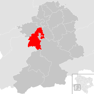
| Location of Gresten-Land in the Scheibbs district | ||
  |
||
 Municipal office Gresten-Land in Gresten |
||
| Source: Municipal data from Statistics Austria | ||

Gresten-Land is a municipality with 1488 inhabitants (as of January 1, 2020) in the Scheibbs district in Lower Austria .
geography
Gresten-Land is located in the Mostviertel in Lower Austria.
The area of the municipality covers 55.48 square kilometers. 48.5 percent of the area is forested. In the municipality of Gresten-Land, the 15th longitude to the east intersects with the 48th parallel north. A meridian stone has been erected at this point.
The highest point in the community is the Schwarzenberg at 958 m above sea level. A.
Community structure
The municipality includes the following four localities (population in brackets as of January 1, 2020):
- Oberamt (385)
- Upper Estate (28)
- Schadneramt (374)
- Sub-Office (682)
The community consists of the cadastral communities Oberamt, Schadneramt and Unteramt.
Neighboring communities
Gresten Land extends east, north and west of the municipality of Gresten . Other neighboring communities are Gaming , Gresten, Randegg , Reinsberg , Scheibbs , Steinakirchen am Forst , Wang , Lunz am See and Ybbsitz .
history
In ancient times, the area was part of the Noricum province .
On April 26, 1945, 16 Hungarian Jews were murdered by members of the SS in Schadneramt.
The community was created in 1968 through the merging of the municipalities of Oberamt, Unteramt and Schadneramt.
coat of arms
Blazon : In a shield divided by silver into green, above a red spike with a golden quillons growing out of the shield, below in green a golden apple hanging from a branch with two golden leaves.
(Quoted verbatim from the church website.)
The coat of arms was awarded to the municipality on the occasion of its constitution in 1968.
Population development
According to the results of the 2001 census , there were 1,544 inhabitants. In 1991 the community had 1,553 inhabitants, in 1981 1,486 and in 1971 1,504 inhabitants.
politics
The municipal council has 19 members.
- With the municipal council elections in Lower Austria in 1990, the municipal council had the following distribution: 15 ÖVP and 4 SPÖ.
- With the municipal council elections in Lower Austria in 1995, the municipal council had the following distribution: 17 ÖVP and 2 SPÖ.
- With the municipal council elections in Lower Austria in 2000, the municipal council had the following distribution: 16 ÖVP, 2 SPÖ and 1 FPÖ.
- With the municipal council elections in Lower Austria in 2005 , the municipal council had the following distribution: 15 ÖVP and 4 SPÖ.
- With the municipal elections in Lower Austria in 2010 , the municipal council had the following distribution: 15 ÖVP and 4 SPÖ.
- With the municipal council elections in Lower Austria in 2015 , the municipal council had the following distribution: 16 ÖVP and 3 SPÖ.
- With the municipal council elections in Lower Austria 2020 , the municipal council has the following distribution: 16 ÖVP and 3 SPÖ.
- mayor
- until 2005 Johann Karner (ÖVP)
- since 2005 Leopold Latschbacher (ÖVP)
Culture and sights
economy
In 2001 there were 25 non-agricultural workplaces, agricultural and forestry operations 162 according to the 1999 survey. According to the 2001 census, the number of people in employment at the place of residence was 741. The 2001 participation rate was 48.31 percent.
Web links
- http://www.gresten-land.gv.at
- 32004 - Gresten-Land. Community data, Statistics Austria .
Individual evidence
- ↑ Statistics Austria: Population on January 1st, 2020 by locality (area status on January 1st, 2020) , ( CSV )
- ^ Klaus-Dieter Mulley: National Socialism in the Political District Scheibbs 1930-1945 (= local history of the district Scheibbs 8) . Scheibbs 1988.
- ^ Result of the local council election 1995 in Gresten-Land. Office of the Lower Austrian State Government, March 30, 2000, accessed on October 12, 2019 .
- ^ Election result of the municipal council election 2000 in Gresten-Land. Office of the Lower Austrian State Government, February 4, 2005, accessed on October 12, 2019 .
- ^ Election result of the municipal council election 2005 in Gresten-Land. Office of the Lower Austrian State Government, March 4, 2005, accessed on October 12, 2019 .
- ^ Election result of the municipal council election 2010 in Gresten-Land. Office of the Lower Austrian State Government, October 8, 2010, accessed on October 12, 2019 .
- ^ Election result of the 2015 municipal council election in Gresten-Land. Office of the Lower Austrian State Government, December 1, 2015, accessed on October 12, 2019 .
- ↑ Results of the municipal council election 2020 in Gresten-Land. Office of the Lower Austrian state government, January 26, 2020, accessed on February 29, 2020 .

Cadastral communities: Oberamt | Schadneramt | Sub-office
Locations: Oberamt | Obergut | Schadneramt | Sub-office
Settlement: Loiblsiedlung Scattered houses: Oberamt | Obergut | Schadneramt | Sub-office
Counting district: Oberamt | Schadneramt | Sub-office