Mitterstockstall
| coat of arms | map |
|---|---|
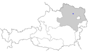
 Location of the place Location of the place
|
|
| Basic data | |
| State : | Lower Austria |
| Political District : |
Tulln district ( TU)
|
| Area : | ? Ha |
| Residents : | 170 (2001 census) |
| Height : | 206 m above sea level A. |
| Postal code : | 3470 |
| Area code : | 02279 |
| Geographic location : | 48 ° 26 ' N , 15 ° 55' E |
| Cadastral municipality number: | ? |
Mitterstockstall is a former municipality and now a cadastral municipality of the market town of Kirchberg am Wagram in the Tulln district in Lower Austria .
geography
The place lies between the places Oberstockstall and Unterstockstall in a valley section of the Gießgraben , which is also called Krampugraben .
history
The place gained importance when Ortlieb von Winkl had the Winklberg Castle built on a hill around 1250 .
Individual evidence
- ↑ Topographies from Mitterstockstall on hf-kirchberg.at
