Engelmannsbrunn
| coat of arms | map |
|---|---|
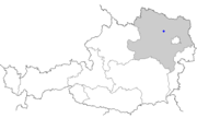
 Location of the place Location of the place
|
|
| Basic data | |
| State : | Lower Austria |
| Political District : |
Tulln district ( TU)
|
| Area : | ? Ha |
| Residents : | 300 (2001 census) |
| Height : | 210 m above sea level A. |
| Postal code : | 3470 |
| Area code : | 02279 |
| Geographic location : | 48 ° 24 ' N , 15 ° 53' E |
| Cadastral municipality number: | ? |
Engelmannsbrunn is a former municipality and now a cadastral municipality of the market town of Kirchberg am Wagram in the Tulln district in Lower Austria .
geography
The cadastral community Engelmannsbrunn lies on the edge of the Tullnerfeld in a valley that descends from the Wagram .
history
Ulrich von Engelsmannbrunn was mentioned in a document as early as 1280.
In 1838 the place had 565 inhabitants. Until 1848 the town was divided several times and groups of houses were under four rule owners, namely Grafenegg Castle , Castle Winklberg , Göttweig and the rule Bierbaum .
Around 1860 the community had 479 inhabitants. In 1946 the then 7.89 km² community had 440 inhabitants.
Famous pepole
- Franz Einzinger (* 1952), Section Head in the Federal Ministry of the Interior
gallery
literature
- Marianne Eckart: 900 years of Engelmannsbrunn history. Village renewal association Engelmannsbrunn, 2015.
Individual evidence
- ↑ Representation of the Archduchy of Austria under the Ens. First volume. District under the Manhartsberg. Mechitaristen, Vienna, 1833. p. 230.
- ↑ Topographies of Engelmannsbrunn in: hf-kirchberg.at
- ↑ Eduard Matzenauer: Lower Austrian community schematic with statistical-tophographic notes. Zahn, Vienna, 1862. p. 50.
- ^ Municipal directory of Austria: Based on a special survey from 1946. Vienna, 1948. P. 54.


