Upper floor stable
| coat of arms | map |
|---|---|
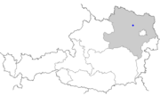
 Location of the place Location of the place
|
|
| Basic data | |
| State : | Lower Austria |
| Political District : |
Tulln district ( TU)
|
| Area : | ? Ha |
| Residents : | 218 (2001 census) |
| Height : | 224 m above sea level A. |
| Postal code : | 3470 |
| Area code : | 02279 |
| Geographic location : | 48 ° 24 ' N , 15 ° 53' E |
| Cadastral municipality number: | ? |
Oberstockstall is a former municipality and now a cadastral municipality of the market town of Kirchberg am Wagram in the Tulln district in Lower Austria .
geography
Oberstockstall is located in the valley of the Gießgraben , which joins the Wiesengraben just above the village . The state road 46 leads through the village, which leads from Altenwörth to Hohenwarth and from which the state road L27 branches off towards Ruppersthal at the end of the village .
history
In the Middle Ages, Gut Oberstockstall was an economic yard of the Diocese of Passau and was expanded into a mansion seat by Canon Christoph von Trenbach in 1548 . For a short time, Oberstockstall was even the seat of the district office of the Oberstockstall judicial district .
Individual evidence
- ↑ Topographies from Oberstockstall on hf-kirchberg.at
