
Under floor barn
| coat of arms | map |
|---|---|
 Location of the place Location of the place
|
|
| Basic data | |
| State : | Lower Austria |
| Political District : |
Tulln district ( TU)
|
| Area : | ? Ha |
| Residents : | 256 (2001 census) |
| Height : | 193 m above sea level A. |
| Postal code : | 3470 |
| Area code : | 02279 |
| Geographic location : | 48 ° 24 ' N , 15 ° 53' E |
| Cadastral municipality number: | ? |
Unterstockstall is a former municipality and now a cadastral municipality of the market town of Kirchberg am Wagram in the Tulln district in Lower Austria .
geography
The place Unterstockstall is on the edge of the Tulln field at the mouth of the well Krampugraben mentioned Gießgrabens that here from Wagram enters the plains and the Danube. The Danube Road used to run through the town; Due to the construction of the Stockerau expressway , this street is now run as Landesstraße 14. At the southeast end of the village there is a stop on the Absdorf – Krems railway line .
history
In the early modern times, the place belonged to the rule of St. Andrä .
gallery

Local chapel
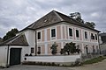
House at LH 14


Individual evidence
- ↑ Topographies from Unterstockstall on hf-kirchberg.at

Cadastral communities: Altenwörth | Dörfl | Engelmannsbrunn | Gigging | Kirchberg am Wagram | Kollersdorf | Mallon | Mitterstockstall | Neustift in the field | Upper floor stable | Under floor barn | Angle
Locations: Altenwörth | Dörfl | Engelmannsbrunn | Gigging | Kirchberg am Wagram | Kollersdorf | Mallon | Mitterstockstall | Neustift in the field | Upper floor stable | Sachsendorf | Under floor barn | Angle
Market place: Kirchberg am Wagram | Villages: Altenwörth • Dörfl • Engelmannsbrunn • Gigging • Kollersdorf • Mallon • Mitterstockstall • Neustift im Felde • Oberstockstall • Sachsendorf • Unterstockstall • Winkl | Groups of houses: Kirchberg am Wagram | Other locations: Altenwörth power station • Oberstockstall Castle • Winkelberg Castle
Counting area: Kirchberg am Wagram | Engelmannsbrunn | Upper floor stable | Mitterstockstall | Under floor barn | Neustift in the field | Winkl | Kollersdorf | Mallon | Dörfl | Altenwörth