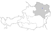
Sachsendorf (municipality of Kirchberg am Wagram)
| coat of arms | map |
|---|---|

|
|
| Basic data | |
| State : | Lower Austria |
| Political District : | Tulln District ( TU ) |
| Area : | Ha |
| Residents : | 133 (2001 census) |
| Height : | 224 m above sea level A. |
| Postal code : | 3474 |
| Area code : | 02738 |
| Geographic location : | 48 ° 23 ' N , 15 ° 52' E |
| Cadastral municipality number: | 20019 |
Sachsendorf belongs to Kollersdorf , a cadastral community of the market town of Kirchberg am Wagram .
geography
The village of Sachsendorf belongs to the cadastral municipality of Kollersdorf and borders on the following cadastral communities: Seebarn am Wagram , Altenwörth , Gigging , Neustift im Felde , Mallon and the municipality of Fels am Wagram .
history
The village, which originally belonged to the Grafenegg rulership , was constituted as a community in 1848 together with Kollersdorf and merged with other communities in 1968 to form the large community of Kirchberg am Wagram .
Individual evidence
- ↑ Topographies of Sachsendorf ( page no longer available , search in web archives ) Info: The link was automatically marked as defective. Please check the link according to the instructions and then remove this notice. on hf-kirchberg.at
