Gigging
| coat of arms | map |
|---|---|
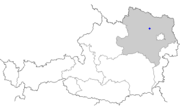
 Location of the place Location of the place
|
|
| Basic data | |
| State : | Lower Austria |
| Political District : |
Tulln district ( TU)
|
| Area : | ? Ha |
| Residents : | 106 (2001 census) |
| Height : | 186 m above sea level A. |
| Postal code : | 3470 |
| Area code : | 02279 |
| Geographic location : | 48 ° 24 ' N , 15 ° 53' E |
| Cadastral municipality number: | ? |
Gigging is a cadastral municipality in the market town of Kirchberg am Wagram in the Tulln district in Lower Austria .
geography
The small town is located in the fertile lowlands of the Tullnerfeld on several silted branches of the Danube .
history
The village, which originally belonged to the Grafenegg rulership , became part of the Altenwörth community in 1848 . In 1868 the Lower Austrian Landtag rejected the application for the establishment of its own municipality by the village, which then had 168 inhabitants. On January 2, 1972, the municipality of Altenwörth was incorporated into the larger municipality of Kirchberg am Wagram, despite objections to the constitutional court .
Individual evidence
- ↑ Topographies of Gigging ( page no longer available , search in web archives ) Info: The link was automatically marked as defective. Please check the link according to the instructions and then remove this notice. on hf-kirchberg.at
- ↑ ris.bka.gv.at
