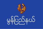
Mon state
Coordinates: 16 ° 10 ′ N , 97 ° 40 ′ E
|
မွန်ပြည်နယ် Mon state |
|

|
|
| Capital | Mawlamyaing |
| surface | 12,296.64 km² |
| population | 2,054,393 (2014) |
| Population density | 167.1 inhabitants per km² |
| ethnicities |
Mon , Burmese , Chin , Kachin , Karen , Arakanese , Shan |
The Mon State ( Burmese မွန်ပြည်နယ် , BGN / PCGN : munbyinè) is one of the 15 administrative units of Myanmar .
geography
The Mon state is in the south of Myanmar. It borders the Bago region to the north, the Kayin State to the east, the Tanintharyi region to the south and the Andaman Sea to the west . In the southeast there is also a narrow border line to the Thai province of Kanchanaburi at the so-called Three Pagoda Pass . About 300 islands off the coast belong to the Mon state.
population
The majority of the population of the Mon state are the Mon people . In addition, other minorities in Burma live in the Mon state.
structure
The Mon state is divided into two districts: Mawlamyine and Thaton .
history
The Mon are considered to be the oldest ethnic group living in today's Burma. 5000 years ago, the first people from what is now western China emigrated to the south. 2500 years ago Mon settled in what is now Bangkok at the mouth of the Mae Nam Chao Phraya ( Chao Phraya River ), but in the following centuries they expanded their settlement area to the mouth of the Irrawaddy .
Around the year 825 the Mon founded the cities of Bago and Thaton . Bago was completely destroyed by the Burmese under King Alaungphaya in 1757. The city had about 150,000 inhabitants at the time.
The area of today's Mon State was annexed by the British colonial government in the second British-Burmese War in 1824 and became part of British India . During the war, the Mon supported the British against their adversary, the Burmese, in the hope of having their own Mon kingdom. After the British victory, hundreds of thousands of Mon emigrated from Thailand to what is now the Mon state.
The Mon State was created in 1974 from the northern part of the Tanintharyi Division and parts of the Bago Division and the Irrawaddy Division . With the founding, the Burmese government tried to take pressure off the Mon's drive for autonomy. In the years after Burma's independence, the Mon continued to strive for independence. In 1949, the Mon Peoples Front was founded by Mon separatists, who started an armed struggle for independence against the central government. In 1962, after the overthrow of the democratically elected government in Rangoon by the military government of General Ne Wins , the New Mon State Party was founded with its armed arm, the Mon National Liberation Army (MNLA). Until 1995 the MNLF waged an armed struggle against the military government. Since then she has been keeping a truce. A treaty with the central government regulates limited autonomy for the New Mon State Party in some areas of the Mon State.


