Moosach (Attel)
| Moosach | ||
|
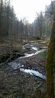
Moosach near Altenburg |
||
| Data | ||
| Water code | DE : 18342 | |
| location | Upper Bavaria | |
| River system | Danube | |
| Drain over | Attel → Inn → Danube → Black Sea | |
| source |
Kitzelsee 48 ° 0 ′ 46 ″ N , 11 ° 51 ′ 31 ″ E |
|
| Source height | approx. 570 m | |
| muzzle |
Attel coordinates: 47 ° 58 '17 " N , 12 ° 1' 37" E 47 ° 58 '17 " N , 12 ° 1' 37" E
|
|
| length | 24.2 km | |
| Catchment area | 76.46 km² | |
| Right tributaries | Doblbach | |
The Moosach is a river in Upper Bavaria . It rises near Moosach ( Ebersberg district ) and flows into the Attel in the Aßlinger district of Holzen .
course
The Moosach rises west of Altenburg, a district of Moosach, at the end of the Winkelelleite. A few hundred meters after the source, the Spiegelbächl, which comes from the Kitzelsee near the Steinsee , flows into the Moosach. It then flows through the Winkelleite, past Altenburg through the village of Moosach, where the Doblbach tributary flows into the Moosach from the right and continues in a south-easterly direction via Bruck and the Brucker Moos until it finally flows into the Attel at the Aßlinger district of Holzen . From the source to the confluence of the engine channel of the former sawmill in the village of Bruck at river kilometer 15.6, the Moosach is a body of water III. Order , then a second order water body. It is assigned to the water type " brooks of the young moraines of the Alpine foothills ".
As a result of massive straightening and partial relocations of the course for hydropower use, the Moosach has lost its original, strongly winding to meandering course except for a few areas and has clearly lost its length. Between Bruck and the confluence with the Attel alone, she lost about 6.5 km. Only in the FFH area " Kupferbachtal , Glonnquellen and Gutterstätter Streuwiesen " and at the Spiegelbach above the Altenburg fish farm does it still have a natural course. In the Brucker Moos, its course has been relocated to the eastern edge of the moor area in the form of the Moosach slope canal in order to improve the feeding of the Pausmühle. The original, also straightened old course in the west of the moor is now called Alte Moosach.
Ecological and chemical status
The Moosach is in poor ecological and chemical condition. Several transverse structures, especially for hydropower plants, block the fish's way. The flow speed is high due to the canalization, so that there are no fish species that require slow-flowing waters. Of 16 possible species of fish, only the grayling ( Thymallus thymallus ), the brown trout ( Salmo trutta ), the bullhead ( Cottus gobio ) and the brook loach ( Barbatula barbatula ) occur. The invasive Canadian waterweed ( Elodea canadensis ) is spreading over wide areas. Chemically, the Moosach is mainly exposed to mercury .
Individual evidence
- ↑ a b c Implementation concepts for hydromorphological measures according to the European Water Framework Directive: Explanation PDF ( page no longer available , search in web archives ) Info: The link was automatically marked as defective. Please check the link according to the instructions and then remove this notice.
- ↑ Catchment area according to: Directory of stream and river areas in Bavaria - Inn river area, page 30 of the Bavarian State Office for the Environment, as of 2016 (PDF; 2.8 MB)
