Morgensternsheide
|
Morgensternsheide District 16 of Neuss |
|
|---|---|
| Coordinates | 51 ° 12 '31 " N , 6 ° 39' 9" E |
| surface | 2.54 km² |
| Residents | 515 (June 30, 2015) |
| Population density | 203 inhabitants / km² |
| Post Code | 41462 |
| Borough | Morgensternsheide (16) |
| Transport links | |
| Federal road |
|
| Source: Timetable information from Stadtwerke Neuss | |
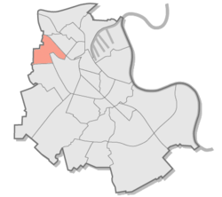
Morgensternsheide is a district in the north of Neuss . 515 inhabitants live here on an area of 2.54 km² (as of June 30, 2015).
The district is located northwest of downtown Neuss and east of Büttgen . The settlement is to the east by the built in time Napeoleons North channel and a railway (tram-line 28 of the Regiobahn limited), to the west through the Bundesautobahn 57 . The Neuss city forest in the southeast belongs to the immediate vicinity .
In surveys in 2001, around 60% of residents said they were satisfied with their surroundings, but complained about the lack of children's playgrounds and kindergartens. The numbers given by the city of Neuss for the Morgensternsheide district with regard to the age groups under 6 years of age bear the note, due to the low number (<5), that they are to be “kept secret” in order not to identify specific individuals.
Web links
Individual evidence
- ↑ Results of the 2001 citizens' survey (PDF; 742 kB)
- ↑ Population structure data for the city of Neuss 2008 (PDF; 165 kB)
