Municipio Isla Mujeres
| Isla Mujeres | ||
|---|---|---|

|
||
| Symbols | ||
|
||
| Basic data | ||
| Country | Mexico | |
| State | Quintana Roo | |
| Seat | Isla Mujeres | |
| surface | 955.9 km² | |
| Residents | 16,203 (2010) | |
| density | 16.9 inhabitants per km² | |
| founding | 1975 | |
| Website | islamujeres.gob.mx/ | |
| INEGI no. | 23003 | |
| politics | ||
| Presidente municipal | Agapito Magaña Sánchez | |
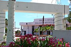
| Palacio Municipal of Isla Mujeres | ||
Coordinates: 21 ° 18 ′ N , 87 ° 0 ′ W
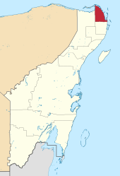
Isla Mujeres is a municipality in the Mexican state of Quintana Roo . The seat of the municipality is the Isla Mujeres of the same name . The municipality had 16,203 inhabitants in 2010, its area is 955.9 km².
geography
The municipality Isla Mujeres is located in the extreme northeast of the state of Quintana Roo between sea level and 100 m . It belongs to the physiographic province of the Yucatán peninsula , more precisely to the sub-province of the Yucatec Karst . Geologically, the municipality is dominated by limestone , the predominant soil type is the Leptosol . More than 60% of the municipality is occupied by rainforests, the rest are mainly mangrove swamps.
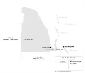
The municipality of Isla Mujeres borders the Caribbean and the Gulf of Mexico as well as the municipalities of Benito Juárez and Lázaro Cárdenas .
places
According to the 2010 census, the municipality Isla Mujeres comprises 104 inhabited localidades , the INEGI classifies the main town Isla Mujeres, which has been the only place on the island of the same name since the incorporation of all other settlements in 2011, as well as Zona Urbana Ejido Isla Mujeres on the mainland in the metropolitan area of Cancun . Apart from these two places, only three places had a population of over 50 in the 2010 census.
| place | Residents |

|
| Isla Mujeres | 12,642 | |
| Zona Urbana Ejido Isla Mujeres | 2,653 | |
| Francisco May | 223 | |
| Punta Sam | 81 | |
| Boca Iglesia | 57 |
Web links
- Enciclopedia de los Municipios y Delegaciones de México: Municipio Isla Mujeres (Spanish)
- INEGI : Datos Geográficos: Municipio Isla Mujeres (Spanish; PDF)


