Municipio Benito Juarez (Quintana Roo)
| Benito Juarez | ||
|---|---|---|

|
||
| Symbols | ||
|
||
| Basic data | ||
| Country | Mexico | |
| State | Quintana Roo | |
| Seat | Cancun | |
| surface | 2107 km² | |
| Residents | 661,176 (2010) | |
| density | 313.8 inhabitants per km² | |
| founding | 1975 | |
| Website | www.cancun.gob.mx/ | |
| INEGI no. | 23005 | |
| politics | ||
| Presidente municipal | Paul Michell Carrillo de Cáceres | |
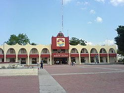
| Palacio Municipal in Cancun | ||
Coordinates: 21 ° 9 ′ N , 87 ° 0 ′ W
Benito Juárez is a municipality in the Mexican state of Quintana Roo . The seat of the municipality is Cancun . The community had 661,176 inhabitants in 2010, its area is 2107 km² .
geography
The municipality of Benito Juárez is located in the northeast of the state of Quintana Roo between sea level and 100 m in the physiographic province of the Yucatán peninsula or in the physiographic sub-province of the Yucatec Karst. Geologically, the municipality is dominated by limestone , the predominant soil type is the Leptosol . 85% of the municipality is occupied by rainforests.
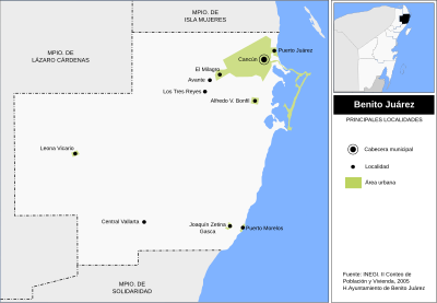
The municipality of Benito Juárez borders the municipalities Lázaro Cárdenas , Isla Mujeres and Solidaridad as well as the Caribbean .
places
According to the 2010 census, the municipality of Benito Juárez comprises 295 inhabited localidades ; the INEGI classifies the capital Cancún as well as Alfredo V. Bonfil, Puerto Morelos and Leona Vicario as urban. In the 2010 census, eight towns had a population of over 50.
| place | Residents |

|
| Cancun | 628.306 | |
| Alfredo V. Bonfil | 14,900 | |
| Puerto Morelos | 9,188 | |
| Leona Vicario | 6,517 | |
| El Porvenir | 505 | |
| Colonia Chiapaneca Siglo XXI | 275 | |
| Lagos del Sol | 156 | |
| Nueva Jerusalem | 71 |
Web links
- Enciclopedia de los Municipios y Delegaciones de México: Municipio Benito Juárez (Spanish)
- INEGI : Datos Geográficos: Municipio Benito Juárez (Spanish; PDF)


