Nahant
| Nahant | ||
|---|---|---|
| Nickname : Hoompa | ||
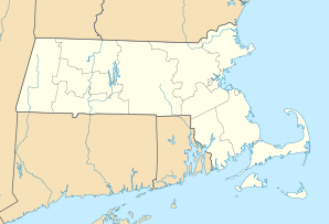
 Nahant in Massachusetts Bay |
||
| Location in Massachusetts | ||
|
|
||
| Basic data | ||
| Foundation : | 1630 | |
| State : | United States | |
| State : | Massachusetts | |
| County : | Essex County | |
| Coordinates : | 42 ° 26 ′ N , 70 ° 55 ′ W | |
| Time zone : | Eastern ( UTC − 5 / −4 ) | |
| Residents : | 3,632 (as of: 2000) | |
| Population density : | 1,135 inhabitants per km 2 | |
| Area : | 40.1 km 2 (approx. 15 mi 2 ) of which 3.2 km 2 (approx. 1 mi 2 ) are land |
|
| Height : | 15 m | |
| Postal code : | 01908 | |
| Area code : | +1 331, 781 | |
| FIPS : | 25-43580 | |
| GNIS ID : | 0618304 | |
| Website : | www.nahant.org | |
Nahant [ nəˈhʌnt ] is a residential community in Essex County in the US state of Massachusetts with 3,632 inhabitants (2000).
history
The natives of the area called the peninsula "Nahant", which means something like "headland" or "almost an island". Nahant juts out into the Massachusetts Bay as a rocky peninsula . In the past it was often used by the residents of the western town of Lynn as pasture for cattle , sheep and goats . The first hotel was built here in 1803 and from 1817 there was a daily connection by steamboat to and from Boston . The municipality has only existed administratively since 1853. At the end of the 19th century the peninsula developed into a leisure and recreational destination. Among other things, the area's first amusement park was built here. During the Second World War , a gun emplacement for the coastal artillery was built on the east side . Now there is the community park and the location of the Marine Science Center of Boston University .
Well-known summer guests
- Frederic Tudor (1783–1864), businessman
- Henry Wadsworth Longfellow (1807-1882), poet
- Henry Cabot Lodge (1850-1924), Senator
- Maurice Prendergast (1858–1924), artist
- Curtis Guild Junior (1860–1915), Governor
- Henry Cabot Lodge Jr. (1902-1985), Senator
- Cleveland Amory (1917-1998), writer
Museums
- Local history museum in the Nahant Community Center
geography
According to the American statistics office , the community is 40.1 km² . Of this, however, only 3.2 km² is land, the rest is water. The peninsula is only connected to the "mainland city" Lynn by a dam.
Demographics
The census in 2000 produced the following results for Nahant: 3,632 people lived in 1,629 households. Of the households, 970 were family households . These households were distributed over 1,704 residential buildings.
Almost all white people live in the community (97.11%).
Among the households there were 49.4% married couples, 7.8% single parent households and 33.8% single households . The proportion of single households of old people was 11.7%.
The average household size was 2.2 inhabitants; the average family size was 2.85 inhabitants.
The age structure of the population of Nahant showed an average age of 45 years. The proportion of those under the age of 18 is 18.6%, that of those over 65 is 19.4%. For every 100 female residents there were 86.7 male residents.
The median household income was 64,052 US $ , the median family income was $ 76,926. Men had significantly higher incomes than women: $ 52,045 to $ 46,522. 1.4% of families and 2.6% of the total population lived below the poverty line. The proportion of those under 18 was 2.7% and that of those over 65 was 2.0%.
School system
Nahant has no secondary school. Up to 6th grade students attend the Johnson Elementary School in Nahant. Grades 7-12 students go to Swampscott and attend Swampscott High School .
Touristic attractions
- The annual " Fourth of July " - fireworks , said of the many locals, it was best around Boston
- The Christmas parade, held annually since 1996 , is one of the largest and most important events in the community.
- As a de facto island, Nahant has no shortage of beaches. That's why Nahant is also a popular seaside resort.
