Nauholzbach
|
Nauholzbach Nauholz |
||
|
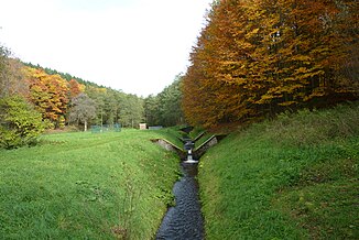
The Nauholzbach just above the Obernautalsperre |
||
| Data | ||
| Water code | DE : 2721342 | |
| location | in the Rothaar Mountains and Siegerland ; District of Siegen-Wittgenstein , North Rhine-Westphalia ( Germany ) | |
| River system | victory | |
| Drain over | Obernau → Sieg → Rhine → North Sea | |
| source | near the iron road of the Rothaargebirge at the Hohenroth forest house 50 ° 55 ′ 42 ″ N , 8 ° 11 ′ 35 ″ E |
|
| Source height | approx. 582 m above sea level NHN | |
| muzzle | near Brauersdorf in the Obernautalsperre the Obernau coordinates: 50 ° 54 '29 " N , 8 ° 10' 0 ' O 50 ° 54' 29" N , 8 ° 10 '0 " O |
|
| Mouth height | 370.9 m above sea level NHN | |
| Height difference | approx. 211.1 m | |
| Bottom slope | approx. 53 ‰ | |
| length | 3.9 km | |
| Catchment area | 6.008 km² | |
| Left tributaries | see opposite | |
| Right tributaries | see opposite | |
The Nauholzbach , also just called Nauholz , is a 3.9 km long, eastern and orographically left tributary of the Obernau in the North Rhine-Westphalian district of Siegen-Wittgenstein . In the urban area of Netphen it mainly flows in the Nauholz district and in the section near the mouth in the Brauersdorf district .
course
The Nauholzbach rises in the southern foothills of the Rothaargebirge . Its source is near the iron road of the Rothaargebirge almost 250 m south-southeast of the Hohenroth forester's house, which is located near a 638.7 m high point at an altitude of about 582 m above sea level. NHN . It runs all the way through the Sauerland-Rothaargebirge nature park and through the Siegerland natural area :
After the Nauholzbach has absorbed two streams on the left just behind its source, it turns through a deeply cut Kerbtal valley to the northwest. After a short time, another tributary follows on the right side, which is fed by two smaller streams. This is followed by two more tributaries on the right. On the left, small rivulets from nearby sources flow into it. After the last small tributary has followed on the right, the Siegstollen leads to the Nauholzbach water from the upper Sieg valley in the Nauholz district .
Finally, the Nauholzbach approximately 2.5 km southeast of the leads not traversed by Bach Brauersdorf , an eastern suburb of Netphen , in the district Brauersdorf to 370.9 m height in the pre-dam on the Südostarm from Obernau carrying Obernautalsperre .
Catchment area and tributaries
The catchment area of the Nauholzbach is 6.008 km².
Natural tributaries
The natural tributaries of the Nauholzbach include (viewed downstream) these rivers:
| Surname | page | Length ( km ) |
Source | Muzzle |
|---|---|---|---|---|
| height ( m above sea level ) | ||||
| nameless? | Left | 0.30 | 590 | 500 |
| nameless? | Left | 0.28 | 570 | 498 |
| nameless? | right | 0.61 | 540 | 460 |
| nameless? | right | 0.85 | 550 | 430 |
| nameless? | right | 0.60 | 550 | 420 |
| nameless? | right | 0.40 | 515 | 410 |
Victory tunnel
In addition, the Nauholzbach takes on the artificially created victory tunnel. Through this, water is branched off from the Sieg as well as the Michelbach and Sindernbach above Walpersdorf and passed through a ridge until it finally increases the water volume of the Nauholzbach.
