New Brunswick Route 1

The New Brunswick Route 1 is a highway in the Canadian province of New Brunswick . It begins near the town of St. Stephen and ends on Route 2 west of Moncton . It is part of the National Highway System , where the route serves as the core route. It is developed as a freeway over the entire route.
course
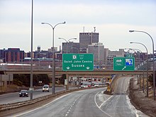
The route begins on the St. Croix River near St. Stephen. The International Avenue Bridge runs across the river and there is a junction with US Highway 1 on the other side of the river . The route first serves as a bypass around St. Stephen and then heads east. Past St. George the route leads to the second largest city in the province, Saint John . Route 7 branches off in front of the city and leads to the provincial capital Fredericton . Route 1 leads into the city and crosses the port of Saint John with the Saint John Harbor Bridge .
From Saint John, the route heads northeast inland. Past the towns of Rothesay , Quispamsis , Hampton and Sussex , it leads to Route 2 , where it ends about 20 km west of Moncton .
Individual evidence
- ↑ Canada's National Highway System - Annual Report 2017. Council of Ministers Responsible for Transportation and Highway Safety, accessed April 3, 2019 .
Web links
- Route description at milebymile.com (English)
