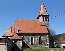
Niederbruck
| Niederbruck | ||
|---|---|---|

|
|
|
| local community | Masevaux-Niederbruck | |
| region | Grand Est | |
| Department | Haut-Rhin | |
| Arrondissement | Thann-Guebwiller | |
| Coordinates | 47 ° 47 ' N , 6 ° 58' E | |
| Post Code | 68290 | |
| Former INSEE code | 68233 | |
| Incorporation | January 1, 2016 | |
| status | Commune déléguée | |
Niederbruck is a former French commune with a last 454 inhabitants (as of 2013) in the Haut-Rhin department in the Grand Est region . It belonged to the Arrondissement of Thann-Guebwiller and the Canton of Masevaux .
With effect from January 1, 2016, the former municipalities of Masevaux and Niederbruck were merged into a commune nouvelle with the name Masevaux-Niederbruck .
geography
Niederbruck lies on both sides of the Doller river in the southeastern Vosges . The summit of the 1074 m high Baerenkopf rises about four kilometers southwest of Niederbruck. The area, located near the border with the Bourgogne-Franche-Comté region , is part of the Ballons des Vosges Regional Nature Park .

Former Mairie
|
Population development
| year | 1962 | 1968 | 1975 | 1982 | 1990 | 1999 | 2007 |
| Residents | 249 | 275 | 305 | 352 | 364 | 369 | 442 |
See also
literature
- Le Patrimoine des Communes du Haut-Rhin. Flohic Editions, Volume 1, Paris 1998, ISBN 2-84234-036-1 , p. 737.
Web links
Commons : Niederbruck - Collection of images, videos and audio files
- Niederbruck on vallee-doller.com (French)

