Niedergladbach
|
Niedergladbach
Community of Schlangenbad
|
|
|---|---|
| Coordinates: 50 ° 6 ′ 17 ″ N , 7 ° 59 ′ 23 ″ E | |
| Height : | 284 m above sea level NHN |
| Area : | 6.59 km² |
| Residents : | 262 (Jun 30, 2013) |
| Population density : | 40 inhabitants / km² |
| Incorporation : | July 1, 1972 |
| Postal code : | 65388 |
| Area code : | 06124 |
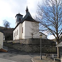
Niedergladbach is the district of the community in Schlangenbad in the Rheingau-Taunus district in Hesse with almost 300 inhabitants , which is the furthest from the main town . In the district, there is a local district with the town council . The Catholic parish church of St. Giles is in Niedergladbach .
geography
Niedergladbach lies at an altitude of 300 meters in the Gladbachtal on the eastern edge of the hinterland forest . The only access road, the L 3035, leads from Hausen vor der Höhe via Obergladbach from a south-easterly direction and on to the Wispertal .
As the only part of the community in Schlangenbad, Niedergladbach has the area code for the district town of Bad Schwalbach.
Coat of arms
Description : In green a golden (yellow), red armored doe, pierced by a silver (white) arrow.
The coat of arms refers to the local church patron, Saint Giles , whose attribute it represents. The saint was already represented in the joint court seal of the communities of Ober- and Niedergladbach and his attribute was included as a proposal for a coat of arms in the Hessian local coat of arms book of 1956.
history
In the run-up to the regional reform in Hesse , the community of Niedergladbach and other communities voluntarily joined the community of Schlangenbad on July 1, 1972. For the Niedergladbach district, as for the other districts, a local district with a local advisory board and a local councilor was set up.
Web links
- Niedergladbach In: website of the community Schlangenbad.
- Niedergladbach. Local history, information. In: www.niedergladbach.com. Private website
- Niedergladbach, Rheingau-Taunus-Kreis. Historical local dictionary for Hessen. In: Landesgeschichtliches Informationssystem Hessen (LAGIS).
- Literature on Niedergladbach in the Hessian Bibliography
Individual evidence
- ↑ a b c figures data facts in: website of the community Schlangenbad, accessed in April 2016.
- ↑ Topographic map 1: 25,000
- ^ Municipal reform in Hesse: mergers and integrations of municipalities from June 21, 1972 . In: The Hessian Minister of the Interior (ed.): State Gazette for the State of Hesse. 1972 No. 28 , p. 1197 , point 851 para. 4. ( Online at the information system of the Hessian State Parliament [PDF; 4.4 MB ]).
- ^ Federal Statistical Office (ed.): Historical municipality directory for the Federal Republic of Germany. Name, border and key number changes in municipalities, counties and administrative districts from May 27, 1970 to December 31, 1982 . W. Kohlhammer, Stuttgart / Mainz 1983, ISBN 3-17-003263-1 , p. 378 .
- ↑ main statute. (PDF; 98 kB) § 6. In: Website. Municipality of Bad Schlangenbad, accessed in February 2019 .


