Notkarspitze
| Notkarspitze | ||
|---|---|---|
|
Notkarspitze |
||
| height | 1888 m above sea level NN | |
| location | Bavaria , Germany | |
| Mountains | Ammergau Alps | |
| Dominance | 2.7 km → Großer Zunderkopf | |
| Notch height | 289 m ↓ Hasenjöchl | |
| Coordinates | 47 ° 33 '13 " N , 11 ° 3' 18" E | |
|
|
||
| Normal way | Ettaler Sattel - Ochsensitz - Ziegelspitz - Notkarspitze | |
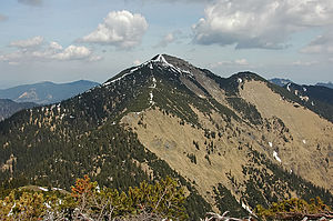
The Notkarspitze is a 1,888 meter high Wasenkogel on the northeastern edge of the Kramer group in the Bavarian part of the Ammergau Alps .
Location and surroundings
The Notkarspitze is located south of the Ammertal , about four kilometers southwest of Ettal , in the Ettal Forest . The top is overgrown with grass and mountain pines , but also has rugged areas. It is the highest point on a ridge that extends more than three kilometers to the east; The Ziegelspitz ( 1719 m ) and the Ochsensitz ( 1515 m , wooded) are prominent pre- peaks . The Notkar is the namesake for the mountain Kar between the east ridge and the shorter north ridge.
The south ridge slopes down to the Gießenbachsattel ( 1600 m ) and the Hasenjoch ( 1688 m ), which is followed by a long ridge with peaks such as the Brünstelskopf ( 1814 m ), the Großer Zunderkopf ( 1895 m ) and the Vorderen Felderkopf ( 1928 m ) .
From the summit there is a view of the Allgäu Alps , the Zugspitze massif and, on a clear day, over the Ammersee and the Starnberger See to Munich.
Hiking trails
The summit can be reached as an easy mountain tour over the three named ridges: from the Ettaler Mühle quite steeply through the Notkar and over the north ridge (AV-Weg 262, 3 hours), from Ettal or from the Ettaler Sattel over the east ridge, or from the Gießenbachsattel over the south ridge (AV-Weg 262); the Gießenbachsattel is accessible from the east from Ettal or Oberau (train station) through the Gießenbachtal or from Farchant via the Reschberg or from the west from Graswang via the Kuhalm and the dilapidated Gießenbach-Alm .
Crossing the Notkarspitze can be combined with crossing the Vorderen Felderkopf to create a very long ridge hike on sometimes very small paths (approx. 7 - 8 hours from Ettal to Graswang).
Literature and map
- Dieter Seibert: Allgäu Alps and Ammergau Alps (= Alpine Club Guide ). 18th edition. Bergverlag Rother , Munich 2008, ISBN 978-3-7633-1126-2 .
- Alpine Club Map 1: 25,000 sheets BY 7, Bavarian Alps: Ammer Mountains East, Pürschling, Hörnle
Web links
Individual evidence
- ↑ Federal Office for Cartography and Geodesy , State Office for Surveying and Geoinformation Bavaria : Digital Topographical Map 1:10 000, [1] , accessed on January 11, 2016
- ^ Dieter Seibert: Alpine Club Guide Allgäu Alps and Ammergau Alps 18th edition, margin no. 2631 . Bergverlag Rother , 2008, ISBN 978-3-7633-1126-2 .
- ^ Alpenvereinskarte 1: 25,000 sheets BY 7, Bavarian Alps: Ammergebirge Ost, Pürschling, Hörnle 1st edition 2009
- ^ Dieter Seibert: Alpine Club Guide Allgäu Alps and Ammergau Alps 18th edition, margin no. 2635 . Bergverlag Rother , 2008, ISBN 978-3-7633-1126-2 .

