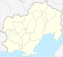
Omchak
| settlement
Omchak
Омчак
|
||||||||||||||||||||||||||||||||
|
||||||||||||||||||||||||||||||||
|
||||||||||||||||||||||||||||||||
Omtschak ( Russian Омчак ) is a settlement in the Magadan Oblast ( Russia ) with 956 inhabitants (as of October 14, 2010).
geography
The place is located about 280 km as the crow flies north-west of the Magadan Oblast Administrative Center in the Kolyma Mountains on the Omtschak River, a left tributary of the right Kolyma tributary Tenka .
Omtschak belongs to the Tenkinsky Rajon and is located 110 km northwest of its administrative center Ust-Omtschug . Despite its own status as a rural settlement, the place is the seat of the township (gorodskoje posselenije) Possjolok Omtschak, which also includes the now almost uninhabited settlement Possjolok imeni Matrossowa (named after Alexander Matrossow ).
history
The settlement developed from a gold prospecting camp set up in 1941 , which from 1944 was called Priisk imeni Tymoshenko (after the war hero Ivan Tymoshenko ). In the 1950s it was given the status of an urban-type settlement under its current name. In 1991 it was converted back into a rural settlement.
Population development
| year | Residents |
|---|---|
| 1959 | 3998 |
| 1970 | 2587 |
| 1979 | 2826 |
| 1989 | 3059 |
| 2010 | 956 |
Note: census data
traffic
Omtschak is located on Tenka Street (Tenkinskaja doroga), which was built in the 1940s as an alternative route to the Kolyma race (today R504, alternatively M56 until 2017 ). It branches off from the latter at Palatka , runs through the Rajon center Ust-Omtschug and, in contrast to the Kolymatrace, extensively to the west around the Kolyma reservoir , to reconnect to the Kolymatrace a few hundred kilometers north, between Sussuman and Mjaundscha .
Individual evidence
- ↑ a b Itogi Vserossijskoj perepisi naselenija 2010 goda. Tom 1. Čislennostʹ i razmeščenie naselenija (Results of the All-Russian Census 2010. Volume 1. Number and distribution of the population). Tables 5 , pp. 12-209; 11 , pp. 312–979 (download from the website of the Federal Service for State Statistics of the Russian Federation)

