Orovnik
| Orovnik Орovник |
||||
|---|---|---|---|---|
|
||||
| Basic data | ||||
| Region : | southwest | |||
| Municipality : | Debarca | |||
| Coordinates : | 41 ° 10 ′ N , 20 ° 45 ′ E | |||
| Height : | 735 m. i. J. | |||
| Residents : | 440 (2002) | |||
| License plate : | OH | |||
| Structure and administration | ||||
| Structure : | no | |||
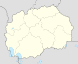
Orovnik , in Cyrillic Оровник , is a small village in the Debarca municipality in southwestern North Macedonia . According to the last census in 2002, the place had 440 inhabitants. The majority were Macedonians who professed the Christian Orthodox faith and called Macedonian as their mother tongue.
Orovnik is only one kilometer north of Lake Ohrid on a western slope at an altitude of around 735 m . The small village stream rises in the eastern range of hills. To the west extends the Struga plain , an agricultural area of around 100 km², which is one of the largest in southwest Macedonia. The Drin , which rises from Lake Ohrid at Struga, flows through them . In addition to cultivated grapevines , there are also many old specimens of the common horse chestnut and the real walnut on the slopes of Orovnik , which is not unusual in this area. Corn , wheat , rye and white cabbage are mostly grown in the fields in the west .
The next places are Gorenci in the north , Misleševo in the west and Podmolje in the south . The municipality capital Belčišta is comparatively far away at about 20 kilometers. However, it does not play a role for Orovnik in economic, social or historical terms. Important cities in the history of Orovnik are and were Ohrid and Struga , both of which are about equidistant (about seven kilometers).
The national road M4 , which connects the state capital Skopje with the Albanian border Qafë Thana southwest of the city of Struga, passes west of the village center. It is part of the Pan-European Transport Corridor 8 . Thus, Orovnik lies on a route that is important throughout Europe. Ohrid Airport , one of Macedonia's two international airports, is even further to the west . Railways have not existed in this part of the country since 1966. Until this year, a narrow-gauge railway ran parallel to the national road and connected Gostivar with Ohrid. The field railway , which originated in World War I , took over 17 hours to cover the 167 kilometers . It did not last in Orovnik, however, but shaped the village image for over 50 years.
The people in Orovnik are traditionally employed in agriculture and livestock. Beekeeping, wine culture and trade also have a long tradition. Today, however, agriculture is facing major problems. Therefore, the residents had to reorient themselves. The majority are commuters who work in trade, tourism or administration from Ohrid and Struga. Many are also unemployed.
The most important sight is the Christian Orthodox Church of St. Elias ( Macedonian Sveti Ilija ) in the village center.
Web links
Individual evidence
- ↑ Census of Macedonia 2002 (by village). (PDF; 2.18 MB) Statistical Office of Macedonia, p. 43 and 139 , accessed on November 1, 2011 (English, Macedonian).
- ↑ Charlie Lewis: The 60 cm Ohrid line in 1965. penmorfa.com, accessed November 1, 2011 (English).
- ^ Church of St Elias (St Ilija). Virtualtourist, accessed on November 1, 2011 (English, pictures and brief information on the village church).

