Podmolje
| Podmolje Подмоље |
||||
|---|---|---|---|---|
|
||||
| Basic data | ||||
| Region : | southwest | |||
| Municipality : | Ohrid | |||
| Coordinates : | 41 ° 10 ′ N , 20 ° 45 ′ E | |||
| Height : | 720 m. i. J. | |||
| Residents : | 331 (2002) | |||
| Postal code : | 6000 | |||
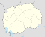
Podmolje ( Macedonian Подмоље ; Albanian Mollas / i ) is a village in the northwest of Opština of Ohrid in the Southwest Region in Macedonia . It is halfway between Ohrid and Struga . The Lake Ohrid is 200 meters to the southwest. In the east it rises to over 1000 m. i. J. a mountain range that divides the plains of Ohrid and Struga. The Struga plain opens to the northwest, where Ohrid Airport is only two kilometers away .
Neighboring towns are Orovnik , Gorno Lakočerej , Dolno Lakočerej , Orman , Ohrid, Struga and Misleševo, turning clockwise from the north .
Podmolje is an important crossroads of the Macedonian traffic axes. The M4 national road with the M5 branches off from the north below the village . It then continues west via Struga to the Macedonian- Albanian border at Čafasan / Qafë Thana . The M5 runs in a south-easterly direction along Lake Ohrid to Ohrid and then continues via Bitola , Veles and Kočani to the Macedonian- Bulgarian border at Stanke Lisičkovo . At the same time, the M4 forms the Pan-European Transport Corridor VIII , starting at Čafasan / Qafë Thana and ending in Skopje , the capital of Macedonia, which is intended to better connect the Adriatic ports of Durrës and Vlora in Albania with the Black Sea ports of Burgas and Varna in Bulgaria. In addition to the complete expansion of the Skopje-Čafasan / Qafë Thana route into a motorway, the Macedonian government is also planning to build a railway line to neighboring Albania and Bulgaria.
Camping Andon Dukov is located south of Podmolje on Lake Ohrid. The Church of St. Erasmus is also to the south along the M5 . In 1974/75 a three-aisled basilica and a necropolis from the Middle Ages, where 124 graves were found between the 6th and 12th centuries, were built a little south of the newer church . An ancient settlement from the Illyrian and Hellenistic times was found above the church on the top of the hill Gabovski Rid . Among other things, the remains of the fortification walls and some building ruins can be seen.
Individual evidence
- ↑ Census of Macedonia 2002. In: State Statistics Office. Retrieved October 11, 2012 (English, PDF file, 2.18 MB).
- ↑ Postcodes Macedonia. (No longer available online.) In: Geopostcodes.com. Formerly in the original ; Retrieved October 11, 2012 (Macedonian). ( Page no longer available , search in web archives ) Info: The link was automatically marked as defective. Please check the link according to the instructions and then remove this notice.
- ↑ Saint Erazmo basilica. In: Makedonija.name. Retrieved October 11, 2012 .

