Ouvèze
| Ouvèze | ||
| Data | ||
| Water code | FR : V6-0200 | |
| location | France | |
| River system | Rhône | |
| Drain over | Rhône → Mediterranean | |
| source | in the municipality of Montauban-sur-l'Ouvèze 44 ° 16 ′ 13 ″ N , 5 ° 32 ′ 11 ″ E |
|
| Source height | approx. 840 m | |
| muzzle | at Sorgues in the Rhone coordinates: 43 ° 59 '23 " N , 4 ° 51' 9" E 43 ° 59 '23 " N , 4 ° 51' 9" E |
|
| Mouth height | approx. 20 m | |
| Height difference | approx. 820 m | |
| Bottom slope | approx. 8.8 ‰ | |
| length | 93.3 km | |
| Catchment area | 2200 km² | |
| Discharge at the Sorgues gauge |
MQ |
25 m³ / s |
| Left tributaries | Toulourenc , Sorgue | |
| Small towns | Vaison-la-Romaine , Bédarrides , Sorgues | |
|
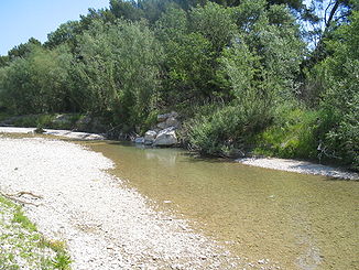
Ouvèze at low tide |
||
|
The Ouvèze (right) flows into a branch of the Rhone |
||
The Ouvèze is a river in southern France that runs through the Auvergne-Rhône-Alpes and Provence-Alpes-Côte d'Azur regions. It flows through the Drôme and Vaucluse departments on its way .
geography
course
The Ouvèze rises in the municipality of Montauban-sur-l'Ouvèze at an altitude of 840 meters, generally drains in a south-westerly direction and flows after 93 kilometers near Sorgues , on the northern municipal boundary of Avignon , as a left tributary into a tributary of the Rhone .
Tributaries
|
left tributaries:
|
right tributaries:
|
Places on the river
- Montauban-sur-l'Ouvèze
- Buis-les-Baronnies
- Pierrelongue
- Mollans-sur-Ouvèze
- Vaison-la-Romaine
- Violès
- Jonquières
- Bédarrides
- Sorgues
traffic
Several roads run along the river, mainly departmental roads. The Orange – Buis-les-Baronnies narrow-gauge railway used to run along the river and is now partially used as a road or cycle path.
See also
Web links
Remarks
- ↑ a b geoportail.fr (1: 16,000)
- ↑ a b The information on the length of the river is based on the information about the Ouvèze at SANDRE (French), accessed on July 31, 2011, rounded to the nearest kilometer.


