Põhimaantee 4
| Põhimaantee 4 in Estonia | |

|
|
| |
|
| map | |
| Basic data | |
| Operator: | Maanteeamet |
| Start of the street: |
Tallinn ( 59 ° 27 ′ N , 24 ° 46 ′ E ) |
| End of street: |
Ikla ( 57 ° 52 ′ N , 24 ° 23 ′ E ) |
| Overall length: | 192.7 km |
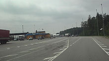
| National road 4 at kilometer 67 (2009) | |
The Põhimaantee 4 (National Highway 4) is a highway in Estonia . It connects the capital Tallinn with the border with Latvia on the Riga Bay . It also forms a section of the European route 67 , the Via Baltica , which leads from Helsinki to Prague .
The length of the road is 192.7 km.
course
The partly motorway-like road runs from Tallinn in a south-southwest direction via Märjamaa to Pärnu . There it reaches the Riga Bay of the Baltic Sea and follows the coast to the border at Ikla just before the Latvian border town of Ainaži , where it reaches the Ikel / Haynasch border crossing . The continuation on the Latvian side is called Autoceļš A1 .
history
During Estonia's membership of the Soviet Union, the road was called Magistrale M12 .
See also
Web links
Commons : Estonian national road 4 - Collection of pictures, videos and audio files


