Packhof (Braunschweig)


The Packhof in the precincts of New Town of Braunschweig described a spacious courtyard, which for several buildings of stone and. T. was surrounded in half-timbered construction . The complex, which probably dates from the end of the 14th or early 15th century, was located directly south of the Neustadtrathaus . Between 1402 and 1671 the site served as the royal stables of the Braunschweig City Council. Like most of the Braunschweig city center , the Packhof and its surroundings were destroyed by the bombing of October 15, 1944 and the resulting fire storm lasting several days and never rebuilt.
history
The Packhof bordered the Schild and Höhe streets . Another, but smaller, Packhof, the Alte Packhof , was located at Mönchstrasse 15, near the Aegidienkirche . From 1402 until the city of Braunschweig lost its independence in 1671, the city council used the spacious area to keep the horses for the mercenaries of the old town , Hagen and Neustadt. After 1671 the newly established city commission met there , which was dissolved again in 1731. Only after this point in time was the site used exclusively as the city's packing yard , which means that all goods arriving in the city had to be declared here first. The Packhof was an important point of contact for traders and merchants who wanted to offer their goods in Braunschweig. Flows of goods into or through the city first had to be declared and stored here. Subsequently, customs duties , including those for the trade fairs held in the city , and excises were levied. So z. B. the revenue of the Packhof from customs duties and the like for the year 1806, 231,000 guilders .
The central building of the Packhof was built between 1789 and 1791 by Christian Gottlob Langwagen as "New Defeat". Two further service buildings ( insurance number 2769 and 2770) were located directly at “Schild” and “Höhe” and together with a gate and two personal gates formed the entrance and end of the Packhof. After the Duchy of Braunschweig joined the German Customs Union in 1842 , the Packhof gradually lost its importance for trade flows within the city.
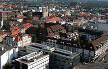
Today the " Welfenhof " shopping arcade, which opened in 1982, is located on the property .
Packhofstrasse
"Packhofstrasse" only existed since 1857, when part of the "Höhe" street was given this name. In the city map of 1671 the street was referred to as "the goat market for the [sic!] Sack". In a copy of the same plan from 1700 and in another plan from 1731 as “the goat market in front of the sack”. However, this name was soon dropped, as the square known today as the wool market was already designated in 1758 as the “goat market”. In addition, there was also the goat market near the Kohlmarkt at that time . The name "Packhofstraße" was canceled again in 1981. In return, the connection between Sack Street through “Welfenhof” and Meinhardshof Street was designated “Packhofpassage”.
New buildings after the Second World War
After the extensive destruction of the bombing war, the construction of the Packhof area and adjacent streets did not begin until the late 1970s. Until then, z. B. the property as a parking lot. In 1974 the almost completely destroyed Neustadtrathaus was rebuilt. In 1982 the “Welfenhof” was finally opened on the site.
The only reminders of the Packhof today are the “Packhof pharmacy”, the “Packhof underground car park”, the “Packhofpassage” and the “Packhof” bus stop located in the immediate vicinity of the original location.
literature
- Jürgen Hodemacher : Braunschweig's streets - their names and their stories. Volume 1: Inner City. Cremlingen 1995, ISBN 3-92706-011-9 .
- Heinrich Meier : The street names of the city of Braunschweig. In: Sources and research on Brunswick history. Volume 1, Wolfenbüttel 1904.
Individual evidence
- ↑ a b c d Jürgen Hodemacher: Braunschweigs Straßen - their names and their stories, Volume 1: Innenstadt , p. 254
- ^ A b c Heinrich Meier: The street names of the city of Braunschweig , p. 81
- ^ Carl Philipp Ribbentrop : Complete history and description of the city of Braunschweig , Part 2, Braunschweig 1796, p. 4
- ↑ Johann Georg Heinrich Hassel: Textbook of Statistics of the European States for higher educational institutions, at the same time as a manual for self-teaching , Weimar 1822, p. 258
- ↑ Gerhard Schildt : The Duchy of Braunschweig between Biedermeier and industrialization , In: Jörg Leuschner , Karl Heinrich Kaufhold , Claudia Märtl (ed.): The economic and social history of the Braunschweigisches Land from the Middle Ages to the present , Volume 3: Modern times , Georg Olms Verlag , Hildesheim 2008, ISBN 978-3-487-13599-1 , p. 124
- ↑ Johannes Angel: Packhof , In: Camerer, Garzmann, Schuegraf, Pingel: Braunschweiger Stadtlexikon , Braunschweig 1992, ISBN 3-926701-14-5 , p. 176
Coordinates: 52 ° 15 ′ 56.8 ″ N , 10 ° 31 ′ 19 ″ E
