Perkins (Maine)
| Perkins | ||
|---|---|---|
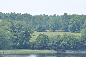
 View of Swan Island |
||
| Location in Maine | ||
|
|
||
| Basic data | ||
| Foundation : | June 24, 1847 | |
| State : | United States | |
| State : | Maine | |
| County : | Sagadahoc County | |
| Coordinates : | 44 ° 4 ′ N , 69 ° 48 ′ W | |
| Time zone : | Eastern ( UTC − 5 / −4 ) | |
| Residents : | 0 (as of 2010) | |
| Population density : | 0 inhabitants per km 2 | |
| Area : | 9.7 km 2 (approx. 4 mi 2 ) of which 5.8 km 2 (approx. 2 mi 2 ) is land |
|
| Height : | 23 m | |
| Postal code : | 04008 | |
| Area code : | +1 207 | |
| GNIS ID : | 0582671 | |
 |
||
Perkins is an Unorganized Territory in Sagadahoc County in the state of Maine in the United States . The area with an area of 9.7 km² is uninhabited.
geography
According to the United States Census Bureau , Perkins has a total area of 9.7 km², of which 5.8 km² is land and 3.9 km² consists of water .
Geographical location
Perkins is located in the northeast of Sagadahoc County on the island of Swan Island in the Kennebec River , just before its confluence with the Atlantic Ocean . You can only get to the island by boat. There are several lakes on the island, such as Big Pond and Wade Pond .
Neighboring communities
All distances are given as straight lines between the official coordinates of the places from the 2010 census.
- Northwest: Richmond , 4 mi
- East: Dresden , Lincoln County, 3.5 mi
- Southeast: Woolwich , 7.3 mi
- Southwest: Bowdoinham , 3.9 mi
history
Swan Island was the settlement area of the Kennebec and when the first Europeans reached the area, a people under the Sachem Sebenoa lived on the island and the surrounding area. They were forcibly displaced by them in a military conflict in 1692. The settlement by European immigrants of the area to which Swan Island in the Kennebec River belongs, began in the middle of the 18th century. On June 24, 1847, Perkins was organized as a town after Thomas Handasyd Perkins, a resident of the island, paid the incorporation fees to the state of Maine. The area previously belonged to the Town of Dresden. In the 19th century, Perkins was a small but thriving community and made a living from shipbuilding and trade. At the 1900 census, there were 61 people in Perkins. At the end of the 19th century, Perkins lost many of its residents to other communities, and the Second World War and the economic crisis led to further population losses. The 1920 census listed only 20 residents and by the 1940s only one family remained in Perkins.
The organization as a town was dissolved in 1917 and ended on March 1, 1918. As Perkins Township, the area was administered directly by the state of Maine. Perkins was part of the Plymouth Claim also the Kennebec Purchase.
The area is now uninhabited and has been placed under protection as a nature reserve. The Swan Island Wildlife Management Area is administered by the Maine Department of Fisheries & Wildlife.
The Swan Island Historic District was registered in 1995 under no. 95001461 Listed and Registered on the National Register of Historic Places .
Web links
Individual evidence
- ^ Perkins in the United States Geological Survey's Geographic Names Information System , accessed February 15, 2020
- ↑ Maine 2010 Census Results ; official publication of the Census Authority, (English; PDF; 32.5 MB)
- ↑ Coordinates of the locations of the Census Authority 2010
- ↑ a b dlsoucy: The Territory of Perkins Maine. In: wordpress.com. 2012, accessed February 15, 2020 .
- ^ Perkins Township, Sagadahoc County - Maine Genealogy. In: mainegenealogy.net. Retrieved February 15, 2020 .
- ↑ Swan Island Wildlife Management Area: Recreational Opportunities: Programs & Resources: Maine Dept of Inland Fisheries and Wildlife. In: maine.gov. Retrieved February 15, 2020 .
- ↑ Swan Island Historic District 95001461

