Pfaffenberg (Vienna)
| Pfaffenberg | ||
|---|---|---|
|
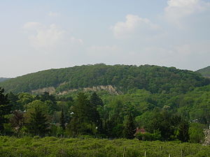
The Pfaffenberg, seen from the Hackenberg |
||
| height | 415 m above sea level A. | |
| location | Vienna , Austria | |
| Mountains | Vienna Woods | |
| Dominance | 0.5 km → Latisberg | |
| Notch height | 16 m ↓ Höhenstraße | |
| Coordinates | 48 ° 15 ′ 34 " N , 16 ° 18 ′ 31" E | |
|
|
||
The Pfaff mountain (also called Pfaff Kogel), a 415-meter-high mountain in the 19th Vienna district Döbling .
geography
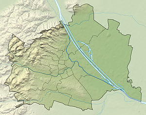
The Pfaffenberg is located northeast of the Neuberg and south of the Latisberg in the Döbling district of Sievering . The mountain lies in a north-eastern extension of the Eastern Alps and is geologically part of the flysch zone , which is composed of sandstone , marl and claystone .
history
The Pfaffenberg was first mentioned in a document in 1340 in connection with its location in Obersievering ( ze Obern Suflern an dem Pfaffenberge ). The name comes from the Old High German Pfaffe .
On Pfaffenberg there is also the sky , which used to be an estate and a restaurant (not to be confused with the Himmelhof in Ober Sankt Veit ) and was initially in spiritual possession, probably an old sky corridor name ('arched corridor, hilltop'). In 1784 the property was acquired by Councilor Binder von Kriegelstein , who had a small castle built there. His successor also created a park that was later used for agriculture.
In a hiking guide from the Biedermeier period , the work " Vienna's Environs for twenty hours in a circle " by Adolf Schmidl from 1835, a description of heaven is given:
- Heaven has its own splendid aqueduct, laid out by Baron Braun in 1792, augmented by the current owner with the inflow of several springs. The origin is in a ravine between the Kobenzl and Lazarus mountains, called the "sinister alley" (Fixsterngasse?), And the length of the line to the edge of the sky is 793 [~ 1500 m] , but to the large pond at 1000 [~ 1900 m] fathoms.
Attractions
Today the sky is especially popular as a destination for the Viennese.
- In the 18th century, Anton Binder von Kriegelstein (1735–1787) had a country house built with a well-known garden, "Am Himmel".
- In the 19th century, more precisely 1854–56, the merchant Johann Carl Freiherr von Sothen finally built the Sisi Chapel on the southern slope of the mountain .
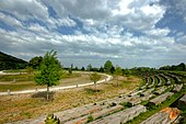
- Tree of Life Circle: In 1997 the Kuratorium Wald am Himmel built a so-called tree of life circle . This consists of forty circularly planted trees, whose (sometimes erroneous) botanical profile and alleged meaning for humans are described in the context of the so-called Celtic tree horoscope on a clay stele (see also Celtomania ). The tree circle is framed in the northwest by square-cut tree trunks, which look like a segment of an amphitheater and serve as seats. For the scientific problems (botanical and ethnological) of this "Celtic tree circle" see also Birkhan . The “Oktogon am Himmel”, an octagonal wooden hut with glass fronts, which houses a small restaurant with a view of the city, is in close proximity .
literature
- Karl Kothbauer: Döbling - and its reed and field names. Dissertation Vienna 2001.
Web links
Individual evidence
- ^ Adolf Schmidl: Vienna's surroundings for twenty hours in a circle. Described by Adolf Schmidl after his own hikes. Printed and published by Carl Gerold, Vienna 1835, p. 210.
- ↑ Christian Hlavac, Lorin Natmessing: The landscape garden "in the sky" on the outskirts of Vienna . In: Die Gartenkunst 21 (1/2009), pp. 117–142.
- ↑ Helmut Birkhan: Observations on the mysterious image of the Celts, especially in Austria. Presentation at the Celtic Conference in Hallein 2010, p. 7 f.
- ↑ Helmut Birkhan: Nachantike Keltenrezeption. Praesens Verlag, Vienna 2009, ISBN 978-3-7069-0541-1 , p. 586, note 3.


