
Pfaffenreuth (Püchersreuth)
|
Pfaffenreuth
municipality of Püchersreuth
Coordinates: 49 ° 47 ′ 15 ″ N , 12 ° 10 ′ 50 ″ E
|
|
|---|---|
| Height : | 469 m |
| Residents : | 100 (Feb 5, 2008) |
| Postal code : | 92715 |
| Area code : | 09681 |

| |
Village Pfaffenreuth (near Windischeschenbach) in the Upper Palatinate / Northern Bavaria |
The village of Pfaffenreuth belongs to the municipality of Püchersreuth in the northern Upper Palatinate and is located 15 kilometers north of Weiden in the Upper Palatinate near Windischeschenbach and Wurz .
history
The first mention was made on November 6, 1302 in a document from Heinrich von Trautenberg, judge von Störnstein. The document is kept in the Regensburg Hospital Archives under document number 1483 .
In 1366/68 Pfaffenreuth was mentioned with five farms in the Salbuch of the Störnstein Castle District. In 1572 it was mentioned with seven farms. Today there are still seven courtyards. Two farms were subordinate to the Waldsassen monastery with the judges' seat in Neuhaus and five belonged to the Störnstein / Neustadt (Lobkowitz) rule .
Population development in Pfaffenreuth from 1819
| year | Residents | building |
|---|---|---|
| 1819 | 49 | 8th |
| 1838 | 59 | 8th |
| 1871 | 52 | 33 |
| 1885 | 66 | 8th |
| 1900 | 74 | 9 |
| 1913 | 54 | 9 |
| year | Residents | building |
|---|---|---|
| 1925 | 70 | 10 |
| 1950 | 71 | 12 |
| 1961 | 58 | 13 |
| 1970 | 66 | k. A. |
| 1987 | 82 | 20th |
| 2011 | 85 | k. A. |
Attractions
- Hollow stone
- Berghölzl
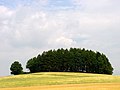
Berghölzl (1999)

Hollow Stone (1999)


Individual evidence
- ↑ Historical Atlas of Bavaria Neustadt ad Waldnaab p. 117
- ↑ Historical Atlas of Bavaria Neustadt ad Waldnaab p. 373
- ↑ https://www.bayerische-landesbibliothek-online.de/landesbeschreibung-orte
- ^ Historical Atlas of Bavaria: Altbayern Series I, Issue 21: Tirschenreuth, p. 387
- ↑ Josepf Lipf (Editor): matrikel bishopric of Regensburg . Ed .: Diocese of Regensburg. Pustet, Regensburg 1838, p. 361 ( digitized version ).
- ↑ Kgl. Statistical Bureau (ed.): Complete list of localities of the Kingdom of Bavaria. According to districts, administrative districts, court districts and municipalities, including parish, school and post office affiliation ... with an alphabetical general register containing the population according to the results of the census of December 1, 1875 . Adolf Ackermann, Munich 1877, 2nd section (population figures from 1871, cattle figures from 1873), Sp. 910 , urn : nbn: de: bvb: 12-bsb00052489-4 ( digitized version ).
- ↑ K. Bayer. Statistical Bureau (Ed.): Localities directory of the Kingdom of Bavaria. According to government districts, administrative districts, ... then with an alphabetical register of locations, including the property and the responsible administrative district for each location. LIV. Issue of the contributions to the statistics of the Kingdom of Bavaria. Munich 1888, Section III, Sp. 858 ( digitized version ).
- ↑ K. Bayer. Statistical Bureau (Ed.): Directory of localities of the Kingdom of Bavaria, with alphabetical register of places . LXV. Issue of the contributions to the statistics of the Kingdom of Bavaria. Munich 1904, Section II, Sp. 888 ( digitized version ).
- ^ Diocese of Regensburg (ed.): Register of the Diocese of Regensburg . ed. i. A. Sr Excellency of the Most Revered Bishop Dr. Antonius von Henle from the Episcopal Ordinariate Regensburg. Regensburg 1916, p. 587 ( digitized version ).
- ↑ Bavarian State Statistical Office (ed.): Localities directory for the Free State of Bavaria according to the census of June 16, 1925 and the territorial status of January 1, 1928 . Issue 109 of the articles on Bavaria's statistics. Munich 1928, Section II, Sp. 896 ( digitized version ).
- ↑ Bavarian State Statistical Office (ed.): Official place directory for Bavaria - edited on the basis of the census of September 13, 1950 . Issue 169 of the articles on Bavaria's statistics. Munich 1952, DNB 453660975 , Section II, Sp. 770 ( digitized version ).
- ↑ Bavarian State Statistical Office (ed.): Official city directory for Bavaria, territorial status on October 1, 1964 with statistical information from the 1961 census . Issue 260 of the articles on Bavaria's statistics. Munich 1964, DNB 453660959 , Section II, Sp. 568 ( digitized version ).
- ^ Bavarian State Statistical Office (ed.): Official place directory for Bavaria . Issue 335 of the articles on Bavaria's statistics. Munich 1973, DNB 740801384 , p. 133 ( digitized version ).
- ↑ Bavarian State Office for Statistics and Data Processing (Ed.): Official local directory for Bavaria, territorial status: May 25, 1987 . Issue 450 of the articles on Bavaria's statistics. Munich November 1991, DNB 94240937X , p. 264 ( digitized version ).
- ↑ atlas.zensus2011.de
Web links

Auerberg | Baumgarten | Botzersreuth | Eppenreuth | Ilsenbach | Kahhof | Kotzenbach | Kronmühle | Lamplmühle | Lindnerhof | Mitteldorf | Pfaffenreuth | Püchersreuth | Rotzendorf | Snot mill | Saint Quirin | Stöberlhof | Thomasberg | Walpersreuth | Root | Brick hut