Pfeiser tip
| Pfeiser tip | ||
|---|---|---|
|
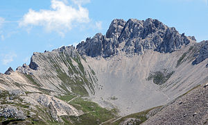
Pfeiserspitze from the west (Pfeishütte) |
||
| height | 2347 m above sea level A. | |
| location | Tyrol , Austria | |
| Mountains | Nordkette , Karwendel | |
| Coordinates | 47 ° 19 '32 " N , 11 ° 26' 42" E | |
|
|
||
| rock | Wetterstein Limestone rocks | |
| Age of the rock | Middle Triassic | |
The Pfeiser tip , also Pfeisspitze , is 2347 m above sea level. A. high mountain in the Karwendel in Tyrol .
Location and surroundings
The Pfeiser Spitze is located in the north chain north of the villages of Rum and Thaur in the Inn Valley . It is the highest point in the northern chain east of the Rumerspitze . To the south-west, the ridge continues to the south-west of the Thaurer Jochspitze ( 2306 m above sea level , ▼ ) before it drops down to Kreuzjöchl . To the east follow the ridge of the Lattenspitze ( 2330 m above sea level , ▼ ) and the Wildangerspitze ( 2153 m above sea level , ▼ ) as well as the Törl transition west of the Haller Zunterkopf . To the north of the Pfeiser Spitze, the Stempeljoch ( 2215 m above sea level ) separates the Pfeisalm with the Pfeishütte in the west from Issanger above the Halltal in the east.
The southern flank of the Pfeiserspitze is schrofendurchsetzten steep grassy slopes and slippers embossed, the north side has rocky character. In addition to the main peak, the Pfeiser Spitze also has a northern secondary peak, the Northern Pfeiser Spitze .
Bases and paths
The bases for the ascent of the Pfeiserspitze are the Pfeishütte ( 1922 m above sea level ) in the northwest, the Thaurer Alm ( 1464 m above sea level ) in the south as well as the Herrenhäuser and Sankt Magdalena in the Halltal ( 1287 m above sea level ). .
On the north side, a short secured path leads from the Pfeishütte to the summit in around 1.5 hours. There is still an easy but brittle transition to the Thaurer Jochspitze. The east-side path from Törl leads easily to the Wildangerspitze and from there, with difficulty II, extremely brittle over the Lattenspitze to the Pfeiser Spitze. The transition to the Northern Pfeiser Peak is significantly more demanding with difficulty IV.
Web links
Individual evidence
- ↑ a b c d Austrian map 1: 50,000, AMAP Online Federal Office for Metrology and Surveying ; Retrieved June 19, 2012
- ↑ a b Heinrich Klier , Fritz March: Alpine Club Guide Karwendel Mountains . Ed .: German Alpine Association , Austrian Alpine Association , Alpine Association South Tyrol . 11th edition. Bergverlag Rother, Munich 1978, ISBN 3-7633-1208-0 , p. 202-204 .
- ↑ www.bergstieg.at: Pfeishütte ( Memento of the original from June 9, 2007 in the Internet Archive ) Info: The archive link was inserted automatically and has not yet been checked. Please check the original and archive link according to the instructions and then remove this notice.

