Fundres high trail
| Fundres high trail | |
|---|---|
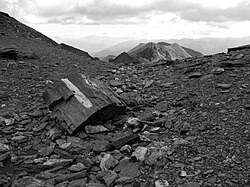
 Rauhtaljoch on the Pfunderer Höhenweg |
|
| Data | |
| length | approx. 70 km |
| Starting point |
Sterzing 46 ° 53 ′ 58 ″ N , 11 ° 27 ′ 31.6 ″ E |
| Target point |
St. Georgen or Pfalzen near Bruneck 46 ° 48 ′ 44 ″ N , 11 ° 53 ′ 1.4 ″ E |
| Type | Höhenweg |
The Pfunderer Höhenweg is a high route and hiking trail in the Alps. Starting in Sterzing about 15 km south of the Brenner Pass , it leads through the secluded and relatively little frequented mountains of Pfunders to St. Georgen or Pfalzen near Bruneck .
history
The Pfunderer Höhenweg was laid out by the Brixen, Bruneck and Sterzing sections of the South Tyrolean Alpine Club .
course
The route of around 70 km in length can be mastered in four to six days and runs through alpine and high alpine terrain at an altitude of between 2000 and 3000 meters. The Höhenweg crosses or touches the municipal areas of Sterzing , Pfitsch , Freienfeld , Mühlbach , Vintl , Mühlwald , Terenten , Kiens , Pfalzen and Bruneck .
On three daily stages, short sections are secured with wire ropes, a few meters on a constant snow field and several hours in pathless terrain by block climbing. Even if no glaciers are touched, the Pfunderer Höhenweg requires a very good physical condition, surefootedness, a head for heights, endurance, orientation skills and experience in the mountains. The path climbs to over 2800 m on the second day (with ascent to the summit over 3100 m). Hikers who are not regularly at such altitudes are therefore advised to acclimatize for a few days before tackling the Pfunderer Höhenweg.
The Fundres Mountains are just south of the main Alpine ridge , but still north of the Pustertal line. Geologically, they belong to the Central Alps , which consist of mica schist , gneiss and granite and whose mountain ridges and narrow V-valleys stretch far. To the south, however, the Pfunderer Höhenweg looks out over the brightly shining towers and peaks of the Dolomites , while in the north the glaciers of Hochfeiler and Hochferner glisten in the Zillertal Alps .
The Trenser-Joch-Bivouac , the Simile-Mahd-Alm , the Brixner Hütte , the Walter-Brenninger-Bivouac , the Edelrauthütte (Eisbruggjochhütte) and the Tiefrastenhütte serve as bases on the Pfunderer Höhenweg .
Stages
| stage | begin | target | Walking time | Characteristic |
|---|---|---|---|---|
| 1 day | Sterzing (Vipiteno) | Trenser-Joch-Bivouac / Simile-Mahd-Alm | 6 h | Ascent from the valley to 2500 m over forest paths and narrow climbs on very sloping meadow slopes; exhausting, demanding to walk |
| 2 day | Trenser-Joch-Bivouac / Simile-Mahd-Alm | Brixner hut | 3 h | High altitude stage over the Wilde See and, if you are interested, over the Wilde Kreuzspitze (3132 m), in bad weather alternative over the Labesebenalm; Except for a few meters over a steep snowfield with footprints of medium difficulty |
| 3rd day | Brixner hut | Walter Brenninger Bivouac | 5 h 30 | High altitude stage over Steinkar, Keller and Dannelscharte over mostly narrow climbs; after the Dannelscharte short passages secured with wire ropes; exhausting, sometimes quite demanding |
| 4th day | Walter Brenninger Bivouac | Edelrauthütte (Eisbruggjochhütte) | 4 h | High altitude stage over the Gaisscharte; pathless, but well-marked terrain, block climbing, after the Gaisscharte short climbing passage secured with wire ropes; very demanding and exhausting |
| 5th day | Edelrauthütte (Eisbruggjochhütte) | Tiefrastenhütte | 6 h | High altitude stage via Kuhscharte, Gruipa Alm, Gampishütte, Passenjoch and Hochsäge; mostly meadow paths over the alpine pastures, towards the end a short stretch with block climbing and a steep descent to the Tiefrastenhütte; easy |
| 6th day | Tiefrastenhütte | St. Georgen / Pfalzen | 7 h | initially a tightrope walk over Kleines Tor, Putzenspitze, Bärentaler Spitze, Sambock and Platte, then the descent into the valley becomes steeper and steeper; moderately difficult on the ridge, meadow paths and entertaining scramble on peaks secured here and there with wire ropes; exhausting due to the long descent and the total length of the stage |
photos
cards
- Tobacco hiking maps (1: 25,000), sheets 037 and 033
Further information
- Michael Isidor Engl, Anton Ribul: Paths in the silence ... Landscapes, customs, people in the South Tyrolean mountains , Bolzano: Verlaganstalt Athesia, 2008. Photo text volume .
Web links
- Detailed description of the high trail and the huts on the website www.edelrauthuette.com (pdf) (886 kB)
- The high trail in stages - huts | Variants | Detour
- Overview of hiking trails in South Tyrol with an interactive map
Individual evidence
- ↑ Hanspaul Menara : South Tyrolean high trails . Athesia, Bozen 1977, p. 135-136 .


