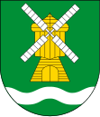
Gmina Ostaszewo
| Gmina Ostaszewo | ||
|---|---|---|

|
|
|
| Basic data | ||
| State : | Poland | |
| Voivodeship : | Pomerania | |
| Powiat : | Nowy Dwór Gdański | |
| Geographic location : | 54 ° 13 ' N , 18 ° 57' E | |
| Residents : | see Gmina | |
| Postal code : | 82-112 | |
| Telephone code : | (+48) 55 | |
| License plate : | GND | |
| Gmina | ||
| Gminatype: | Rural community | |
| Gmina structure: | 11 localities | |
| 7 school offices | ||
| Surface: | 60.65 km² | |
| Residents: | 3206 (June 30, 2019) |
|
| Population density : | 53 inhabitants / km² | |
| Community number ( GUS ): | 2210032 | |
| administration | ||
| Wójt : | Michał Chrząszcz | |
| Address: | Ostaszewo 74 82-112 Ostaszewo |
|
| Website : | www.ostaszewo.pl | |
The Gmina Ostaszewo is a rural community in the powiat Nowodworski in the Polish Pomeranian Voivodeship . It has an area of 60.65 km², on which 3206 people live (June 30, 2019). Their seat is the village of the same name ( German : Schöneberg ).
geography
The rural community is located in Pommerellen in the area of the Great Marienburger Werder . In the west, the Vistula forms the border between the municipality and the city of Gdansk . In the east are the small towns of Nowy Dwór Gdański (Tiegenhof) and Nowy Staw (Neuteich) . 83 percent of the area is used for agriculture, there is no forest.
history
From 1975 to 1998 the rural community belonged to the Elblag Voivodeship .
Community structure
The seven localities listed in the table, each with a Schulzenamt, belong to the rural community .
| Polish name | German name | Pop. (2011) |
location | image |
|---|---|---|---|---|
| Gniazdowo | Schönhorst | 262 | (Location) |

|
| Jeziernik | Schönsee | 306 | (Location) |

|
| Nowa Cerkiew | Neukirch | 462 | (Location) |

|
| Nowa Kościelnica | Neumunsterberg | 296 | (Location) |

|
| Ostaszewo | Schöneberg | 1017 | (Location) |

|
| Palczewo | Palschau | 331 | (Location) |

|
| Piaskowiec | sand | ? | (Location) |
- Other localities in the municipality
| Polish name | German name | Pop. (2011) |
location | image |
|---|---|---|---|---|
| Groblica | Niederdamm | 162 | (Location) | |
| Komarówka | Oberfeld | 122 | (Location) | |
| Lubiszynek Pierwszy | - | 81 | (Location) | |
| Pułkownikówka | - | 142 | (Location) |
Culture and sights
Architectural monuments
- Parish Church św. Jerzego in Jeziernik (14th - 17th centuries)
- Parish Church św. Marcina (1879–1879) in Nowa Cerkiew
- Parish Church św. Jana Chrzciciela (1874) in Ostaszewo
- Church ruins in Ostaszewo (14th - 19th centuries)
- Church pw Matki Boskiej Częstochowskiej (1712, 1896) in Palczewo
- Arbor house in Gniazdowo
- Arbor house in Nowa Kościelnica (No. 50/51)
- Arbor house in Nowa Kościelnica (No. 64/65)
- Windmill in Palczewo (19th century).
Personalities
- Claas Epp (* 1803 in Schönsee; † 1881), founder of two Mennonite colonies in what was then the empire of the Russian tsar.
Web links
- Official website of Gmina Ostaszewo (Polish)
Footnotes
- ↑ population. Size and Structure by Territorial Division. As of June 30, 2019. Główny Urząd Statystyczny (GUS) (PDF files; 0.99 MiB), accessed December 24, 2019 .
- ↑ The Historical Place Directory


