
Piz Barscheinz
| Piz Barscheinz | ||
|---|---|---|
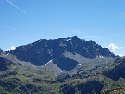
 Piz Neir and to the right of it Piz Barscheinz, taken from above Bivio. |
||
| height | 2616 m above sea level M. | |
| location | Canton of Graubünden , Switzerland | |
| Mountains | Albula Alps | |
| Dominance | 0.1 km → Piz Neir | |
| Notch height | 3 m ↓ ridge between Piz Barscheinz and Piz Neir | |
| Coordinates | 771 793 / 149683 | |
|
||

The Piz Barscheinz is a rock head east of the Julier Pass and northwest of Bivio in the canton of Graubünden in Switzerland with an altitude of 2616 m above sea level. M. It is a ridge of the Piz Neir , which breaks off to the south in a short rock step. The rock head is often visited as a viewing platform . The name Barscheinz is mentioned in a document in 1467, but its origin is unknown.
Location and surroundings
The Piz Barscheinz belongs to the Err area, a subgroup of the Albula Alps . It is located entirely in the municipality of Surses . The rock head is completely surrounded by the Oberhalbstein .
The neighboring peaks include the Piz Neir in the north and the Bleis Muntaneala in the west.
The valley location is Bivio , a frequent starting point is Bögia on the Julier Pass road.
Routes to the summit
Summer routes
From Bivio
From Bögia
- Starting point: Bögia ( 1906 m ) on the Julier Pass road
- Via: Craps
- Difficulty: EB
- Time required: 1¾ hours
Winter route
In winter, if the conditions are safe, in spring the Piz Barscheinz is climbed as an extension of the Bleis Muntaneala ( 2452 m ). The reserve Craps is observed!
panorama

gallery

Looking down to Bivio .

View down to the Lai da Marmorera .

Looking north to Piz Neir

Looking east to Piz Bardella and Piz Julier .
View to the southeast to Piz Lagrev .

View to the south to Piz Materdell and Piz Fedoz .

View to the south to Piz Badile .

Looking west to Piz Platta .

View to the northwest to Piz Forbesch and Piz Arblatsch .


literature
- Manfred Hunziker: Club guide, Bündner Alps . From the Septimer to the Flüela. 3. Edition. Vi. Verlag des SAC, 2000, ISBN 3-85902-187-7 , p. 159-160 .
- Vital Eggenberger: Ski tours Graubünden South . Verlag des SAC, 2010, ISBN 978-3-85902-301-7 , pp. 141 .
- National map of Switzerland, sheet 1256 Bivio, 1: 25,000, Federal Office of Topography, 2009 edition.
Web links
Individual evidence
- ↑ Andrea Schorta: How the mountain got its name . Small Rhaetian name book with two and a half thousand geographical names of Graubünden. Terra Grischuna Verlag, Chur and Bottmingen / Basel 1988, ISBN 3-7298-1047-2 , p. 66 .