
Piz Scalotta
| Piz Scalotta | ||
|---|---|---|
 Piz Surparé (left), Piz Scalotta (middle) and Crap da Randons (right) |
||
| height | 2991 m above sea level M. | |
| location | Canton of Graubünden , Switzerland | |
| Mountains | Oberhalbsteiner Alps | |
| Dominance | 0.83 km → Piz Surparé | |
| Notch height | 63 m ↓ ridge between Piz Scalotta and Piz Surparé | |
| Coordinates | 765 580 / 149089 | |
|
||
| Normal way | About the Val Gronda | |

The Piz Scalotta (Scalotta is the diminutive of scala , which translated from Latin means 'stairs'.) Is a mountain northwest of Bivio and northeast of Juf in the canton of Graubünden in Switzerland with a height of 2991 m above sea level. M. It is a popular ski touring mountain.
Location and surroundings

The Piz Scalotta belongs to the Piz Platta group , a sub -group of the Oberhalbsteiner Alps . It offers an impressive view of the Piz Platta group. The Piz Scalotta is located in the area of the municipality of Surses .
The neighboring peaks of Piz Scalotta include Piz Surparé ( 3077 m ), Massaspitz ( 3163 m ), Jupper Horn ( 3155 m ) or Tälihorn ( 3163 m ). South of the mountain is the 2581 m high Stallerberg pass , which leads from Juf to Bivio. West of the mountain, the 2838 m high Fallerfurgga ( Rhaeto-Romanic Fuorcla da Faller ) ( 2837 m ) leads from Juf to Tga (Mulegns).
Valley locations and frequent starting points for climbing Piz Scalotta are Bivio and Juf .
The farthest visible point from Piz Scalotta is the Äbeni Flue (also Ebnefluh) in the west and is 126 km away. Above the 3961 m above sea level. M. high mountain runs the border between the Swiss cantons of Bern and Valais .
Routes to the summit
Summer routes
About Val Gronda
From Stalveder
- Starting point: Stalveder ( 1713 m )
- Via: Eva da sur Rang, Val Gronda
- Difficulty: EB
- Time required: 3 ¼ hours from Stalveder
Over the western slope
- Starting point: Tga ( 1927 m ) or Juf ( 2117 m )
- Via: Fuorcla da Faller ( 2838 m )
- Difficulty: BG until Fuorcla da Faller as trail white-red-white marks
- Time required: 3 ¾ hours from Tga, 3 ¼ hours from Juf
About the Muntognas digls Lajets
- Starting point: Lai da Marmorera dam ( 1684 m ) or Tga ( 1927 m )
- Via: Muntognas digls Lajets
- Difficulty: BG
- Time required: 5½ hours from the Marmorera dam, 5½ hours from Tga
- Alternative: via Muttans
Winter routes
About the Val Gronda
- Starting point: Bivio ( 1769 m )
- Via: Val Gronda
- Exposures: E, NE
- Difficulty: WS +
- Time required: 4 hours from Bivio
Descent through the Val Gronda to Stalveder
panorama

gallery
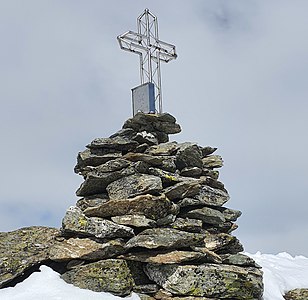
Stone man and cross on the summit.

Piz Surparé , south of Piz Scalotta.

Piz Forbesch (left) and Piz Arblatsch , taken from Piz Scalotta.


literature
- Manfred Hunziker: Club guide, Bündner Alps . Obverse. 1st edition. tape III . Verlag des SAC, 1994, ISBN 3-85902-140-0 , p. 229 .
- Vital Eggenberger: Ski tours Graubünden South . Verlag des SAC, 2010, ISBN 978-3-85902-301-7 , pp. 92-93 .
- National map of Switzerland, sheet 1256 Bivio, 1: 25,000, Federal Office for Topography, 2001 edition.
Web links
- Calculated 360 ° panorama from Piz Scalotta
- Tour reports on www.hikr.org
Individual evidence
- ↑ Andrea Schorta: How the mountain got its name . Small Rhaetian name book with two and a half thousand geographical names of Graubünden. Terra Grischuna Verlag, Chur and Bottmingen / Basel 1988, ISBN 3-7298-1047-2 , p. 128 .
- ↑ Calculated 360 ° panorama ( U. Deuschle ; information ) from Piz Scalotta