
Piz Surparé
| Piz Surparé | ||
|---|---|---|
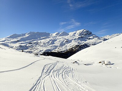
 Piz Surparé taken from Tua (Tgavretga, Bivio ski area) |
||
| height | 3078 m above sea level M. | |
| location | Canton of Graubünden , Switzerland | |
| Mountains | Oberhalbsteiner Alps | |
| Dominance | 2.89 km → Tälihorn | |
| Notch height | 240 m ↓ Fallerfurgga | |
| Coordinates | 765 643 / 148 251 | |
|
||
 Steinmann on the Piz Surparé. |
||

The Piz Surparé ( Rhaeto-Romanic sur for 'about' and paré for 'wall') is a mountain west of Bivio and northeast of Juf in the canton of Graubünden in Switzerland at an altitude of 3,078 m above sea level. M. The mountain has a double peak consisting of two 200 m apart rock heads, of which the western one is a few meters higher. In summer it is seldom visited because of the endless scree slopes and the crumbly, sometimes razor-sharp rock. In winter, however, it is easy to reach and is often used in spring, mainly because of the magnificent sulz snow descent over the SE slopes. In the Steinmann on the summit there is a summit book, well hidden.
Location and surroundings
The Piz Surparé is the highest peak in the Piz Turba - Piz Scalotta chain, a sub-group of the Oberhalbsteiner Alps . The municipal border between Mulegns and Bivio , which today both belong to Surses , ran above the summit . However, the border with Avers is only 170 m south of the summit. The Piz Surparé is bordered in the southeast by the Averstal, a side valley of the Hinterrhein, in the northwest by the Val Bercla, in the northeast by the Val Gronda and in the southeast by the Valetta da Beiva. The last three are side valleys of the Oberhalbstein .
The neighboring peaks include Piz Scalotta in the north, Crap da Radons in the east, Uf da Flüe in the south, Mazzaspitz in the west and Piz Platta in the northwest. South of the mountain is the 2581 m high Stallerberg pass , which leads from Juf to Bivio. West of the mountain, the 2838 m high Fallerfurgga ( Rhaeto-Romanic Fuorcla da Faller ) leads from Juf to Tga (Mulegns).
On the southern flank of Piz Surparé you can find at 2682 m above sea level. M. the river lakes.
Valley locations are Juf and Bivio.
Routes to the summit
Summer routes
Over the south ridge
- Starting point: Juf ( 2117 m ) or Bivio ( 1769 m )
- Via: Stallerberg, Flüeseen
- Difficulty: BG , II +
- Time required: 4¼ hours from Bivio, 3 hours from Juf, 1¾ hours from Stallerberg
Through the southern hollow
- Starting point: Juf ( 2117 m ) or Bivio ( 1769 m )
- Via: Stallerberg, through the scree, to the saddle between the two peaks
- Difficulty: EB
- Time required: 4¼ hours from Bivio, 3 hours from Juf, 1¾ hours from Stallerberg
Over the western slope
- Starting point: Juf ( 2117 m ) or Mulegns ( 1482 m )
- Via: Fallerfurgga ( Fuorcla da Faller , 2838 m )
- Difficulty: WS until Fallerfurgga as trail white-red-white highlighted
- Time required: 5 hours from Mulegns (3½ hours from Tga), 3 hours from Juf, 50 minutes from Fallerfurgga
Over the north ridge
- Starting point: Piz Scalotta ( 2992 m )
- Via: Over the block ridge
- Difficulty: WS
- Time required: 1¼ hours
Winter routes
From Bivio
- Starting point: Bivio ( 1769 m )
- Via: Cresta da Radons ( 1796 m ), south of Crap da Radons ( 2370 m ), Plang Tguils, saddle between the two peaks
- Exposures: O, SO
- Difficulty: WS +
- Time required: 4 hours
- Note: ski depot on the saddle between the two peaks
From Juf
- Starting point: Juf ( 2117 m )
- Via: Stallerberg ( 2581 m ), southeast slope
- Exposures: SW, SO
- Difficulty: WS +
- Time required: 3 hours
- Alternative: On the descent to the Plang Tguils plain and then climb back to the Stallerberg (+20 minutes)
- Note: ski depot on the saddle between the two peaks
Departure to Stalveder
|

panorama

gallery

View to the east to the Julier Pass , in the foreground the Crap da Radons.

View to the northwest to Piz Platta .

View north to Piz Forbesch (left) and Piz Arblatsch (right).

Looking east to Piz Julier .

Piz Surparé (center) taken from Capalotta ( Julierpassstrasse ).
From left to right Piz Surparé, Piz Scalotta , Muntognas digls Lajets and just above the ridge Piz Platta


literature
- Manfred Hunziker: Club Guide, Bündner Alpen, Volume III (obverse). 1st edition. Verlag des SAC, 1994, ISBN 3-85902-140-0 , p. 228.
- Vital Eggenberger: Ski tours Graubünden South. Verlag des SAC, 2010, ISBN 978-3-85902-301-7 , pp. 91-92.
- National map of Switzerland, sheet 1256 Bivio, 1: 25000, Federal Office of Topography, edition 2001.
- National map of Switzerland, sheet 268S Julierpass, 1: 50000, Federal Office of Topography, 2012 edition.