Río Ichu
| Río Ichu | ||
|
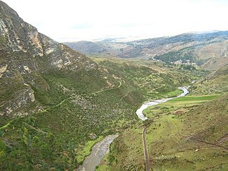
Río Ichu east of Huancavelica |
||
| Data | ||
| location |
|
|
| River system | Amazon | |
| Drain over | Río Mantaro → Río Ene → Río Tambo → Río Ucayali → Amazon → Atlantic Ocean | |
| Confluence of | Río Cachimayo and Río Astobamba 12 ° 50 ′ 42 ″ S , 75 ° 6 ′ 0 ″ W |
|
| Source height | 4090 m | |
| muzzle |
Río Mantaro Coordinates: 12 ° 32 ′ 4 " S , 74 ° 55 ′ 47" W 12 ° 32 ′ 4 " S , 74 ° 55 ′ 47" W |
|
| Mouth height | approx. 2840 m | |
| Height difference | approx. 1250 m | |
| Bottom slope | approx. 18 ‰ | |
| length | approx. 70 km (with source rivers: approx. 105 km) | |
| Catchment area | approx. 1400 km² | |
| Left tributaries | Río Pallca | |
| Medium-sized cities | Huancavelica | |
| Small towns | Acoria , Ascensión , Yauli | |
| Communities | Mariscal Cáceres | |
|
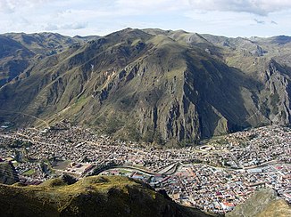
Río Ichu in the Huancavelica metropolitan area |
||
The Río Ichu is an approx. 70 km (including source rivers: approx. 105 km) long right tributary of the Río Mantaro in the Huancavelica region in the Andean highlands in the south-west of central Peru .
River course
The Río Ichu arises 15 km west-southwest of the city of Huancavelica at an altitude of 4090 m at the confluence of the Río Cachimayo (left, 24 km) and Río Astobamba (right, 35 km). The source rivers arise near the continental divide in the east of the Peruvian Western Cordillera . The Río Ichu initially flows 12 km to the northeast, then 20 km to the east. At river kilometer 50 the Río Ichu flows through the agglomeration of Huancavelica. In the lower reaches, the Río Ichu turns north and finally north-northwest. He passes the small towns of Acoria and Yauli . 5 km above the mouth, the Río Pallca meets the Río Ichu on the left. This finally flows into the eastward flowing Río Mantaro at an altitude of 2840 m at Mariscal Cáceres .
Catchment area and hydrology
The catchment area of the Río Ichu covers an area of about 1400 km². It borders in the northwest on that of the Río Vilca , in the central north on that of the Río Alauma, in the east and south on that of the Río Cachi , in the extreme southwest on that of the Río Pampas and in the west on the catchment areas of the Pacific tributaries Río Pisco and Río San Juan . Most rainfall, and therefore the highest runoff, usually occurs between January and April.

