Río Tambo (Pacific Ocean)
|
Río Tambo Río Ichuña |
||
|
Río Tambo near Ichuña |
||
| Data | ||
| location |
|
|
| River system | Río Tambo | |
| Confluence of | Río Uturuncane and Río Crucero in the Western Cordillera 16 ° 9 ′ 3 ″ S , 70 ° 28 ′ 10 ″ W |
|
| Source height | approx. 3800 m | |
| muzzle |
Pacific Ocean Coordinates: 17 ° 10 ′ 16 ″ S , 71 ° 50 ′ 21 ″ W 17 ° 10 ′ 16 ″ S , 71 ° 50 ′ 21 ″ W |
|
| Mouth height | 0 m | |
| Height difference | approx. 3800 m | |
| Bottom slope | approx. 15 ‰ | |
| length | approx. 258 km (including source rivers: approx. 290 km) | |
| Catchment area | 13,362 km² | |
| Drain |
MQ |
34.75 m³ / s |
| Left tributaries | Río Coralaque, Río Carumas | |
| Right tributaries | Río Paltuture, Río Para, Río Capilla | |
| Communities | Ichuña , Yunga , Lloque | |
|
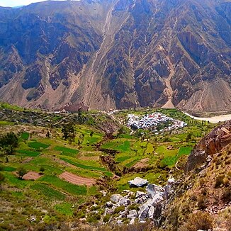
The municipality of Lloque in the foreground, behind in the valley of the Río Tambo |
||
The Río Tambo (in the upper reaches also Río Ichuña ) is an approx. 258 km (including source rivers: approx. 290 km) long tributary of the Pacific Ocean in the south of Peru in the regions Moquegua and Arequipa .
River course
The Río Tambo arises 8 km east of the municipality Ichuña at an altitude of about 3800 m at the confluence of the Río Uturuncane and Río Crucero in the Peruvian western cordillera . The source rivers arise 40 km southwest of the city of Puno on Lake Titicaca in a mountain range up to 5353 m high. The Río Tambo initially flows 25 km to the west and then turns south. The Río Tambo passes the district administration centers Ichuña and Yunga . At river kilometer 150, the river turns sharply towards west-southwest and maintains this direction of flow up to its mouth. In the last 90 kilometers it flows through the arid, arid coastal region of southern Peru. Along a 40 km stretch of river above the estuary, the river is bordered by irrigated agricultural areas. At river kilometer 25, the Panamericana Sur highway crosses the river. The mouth of the Río Tambo into the sea is 75 km northwest of the coastal town of Ilo and 25 km southeast of the coastal town of Mollendo .
Catchment area and hydrology
The Río Tambo drains an area of 13,362 km². In the west the catchment area borders on that of the Río Quilca , in the east on that of the Río Moquegua . In the north the watershed runs along the Peruvian Western Cordillera. The mean discharge is 34.75 m³ / s.
ecology
The shrimp species Cryphiops caementarius from the family of rock and partner shrimp (Palaemonidae) occurs in the Río Tambo . To the west of the river mouth is the sanctuary of the Santuario nacional Lagunas de Mejía .
Individual evidence
- ^ Camarón del Rio . Instituto del Mar del Peru - IMARPE. Retrieved September 25, 2019.

