
Puno
| Puno | ||
|---|---|---|
|
Coordinates: 15 ° 51 ′ S , 70 ° 1 ′ W Puno on the map of Peru
|
||
| Basic data | ||
| Country | Peru | |
| region | Puno | |
| province | Puno | |
| City foundation | November 4, 1668 | |
| Residents | 125,018 (2017) | |
| - in the metropolitan area | 128,637 | |
| City insignia | ||
 |
|
|
| Detailed data | ||
| height | 3827 m | |
| Waters | Lake Titicaca | |
| Time zone | UTC -5 | |
| City Presidency | Martín Ticona Maquera (2019-2022) |
|
| Website | ||
|
|
||

Puno is the capital of the Puno region . It is located in the district of the same name in the Puno Province . The city had 125,018 inhabitants in the 2017 census. The population in the metropolitan area was 128,637. It is 3,800 m high on the shores of Lake Titicaca in the south of Peru .
The city is the seat of the Diocese of Puno, established in 1861 .
Puno is also known under the name "Ciudad de Plata" ( German: the city of silver ). The name comes from earlier times when the silver mines in Puno were among the most productive in Peru.
Geography and climate
The city of Puno is located directly on Lake Titicaca. The district of Puno includes - not counting the floating islands of the Urus - 43 small and tiny islands near the city. They have between 3 and 51 inhabitants (as of 2017). There are also five tiny unnamed islands, numbered as Isla Sin Nombre 1 to Isla Sin Nombre 5 ("Island without a Name").
The cold, semi-arid climate is significantly influenced by this. The rainy season starts in October and ends at the end of April. The annual average temperatures are between 14 ° C and 3 ° C.
history
Puno was founded on November 4, 1668 by Viceroy Pedro Fernández Castro Andrade , the Conde de Lemos .
traffic
Puno is the terminus of the Peruvian Southern Railway (Ferrocarril del Sur) from Matarani with a connection to Cusco . Regular passenger services on the railway to and from Arequipa have been discontinued with the exception of charter services (source www.perurail.com). Local transport with trains was discontinued in 1999 in favor of the more comfortable and faster (long-distance) bus routes. Numerous long-distance bus routes connect Puno with the rest of the country. The nearest airport is in Juliaca , around 50 km away.
Puno also has a port from which mainly commercial and passenger transports to the various islands on Lake Titicaca and to neighboring Bolivia are made. There is a lighthouse on the pier .
Culture and sights

Puno is a popular starting point for excursions to the islands in Lake Titicaca and other attractions in the area.
In addition to the real islands in Lake Titicaca, there are also the floating islands of the Urus ; These are artificial islands made from reed grass, on which approx. 2,000 Uro-Indigenos live.
Cathedral The Cathedral of Puno is a Roman Catholic church and was built in the 17th century on the Plaza Mayor (main square) in the Spanish Baroque style. The front was decorated by the Peruvian sculptor Simón de Asta with decorative elements from the regional flora and fauna. Inside the church, the Spanish baroque mixes with elements of the Andean culture.
Arco Deustua A stone arch built in memory of the patriots who died fighting for the freedom of Peru.
Balcón del Conde de Lemus ( Eng. The Duke's Balcony ) This building was one of the first in Puno and was erected after the city was founded in 1668. According to stories, Viceroy Pedro Antonio Fernández de Castro lived in the house to quell a regional uprising. Today there is a gallery and the branch of the National Cultural Institute in the house.
- "Casa del Corregidor"
- Huajsapata hill
- Viewpoint "Kuntur Huasi"
- Viewpoint "Puma Uta"
- Market stalls at the harbor as well as the daily market in the city, in which mainly locals go about their business.
- Sillustani, tomb towers from the 13th to 14th centuries of the Kolla culture; about 30 km west of Puno
The Reserva Nacional del Titicaca includes a wide area of reeds in front of Puno. Boat tours show visitors the natural beauty of the lake.
Town twinning
-
 La Paz (1984), Bolivia
-
Santa Cruz de la Sierra (1989), Bolivia
School partnership
The girls' school "Colegio Santa Rosa" has a school partnership with the Graf-Stauffenberg-Gymnasium in Osnabrück . This partnership has existed for over 20 years and serves the intercultural exchange between the students in Germany and Peru. School delegations visit each other at regular intervals in order to keep the partnership alive.
military
In Puno there is the Cuartel Manco Cápac (also called Fuerte Manco Cápac ). The city also houses the headquarters of the 6a Brigada de Fuerzas Especiales .
Personalities
- Teodoro Valcárcel - (1900–1942), composer
- Gilberto Cueva Fernández (1926-2010), musician
- Edgar Valcárcel (1932–2010), composer
Picture gallery

Puno in the early morning

Andean Railway on Lake Titicaca

View of Lake Titicaca at sunrise
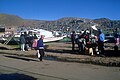
At the port of Puno

Hotel complex in Lake Titicaca
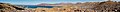
Panorama Puno


Individual evidence
- ↑ Peru: Region Puno - Provinces & Places . www.citypopulation.de. Retrieved December 23, 2019.
- ↑ Perú: Perfil Sociodemográfico (PDF, 27.4 MB) Instituo Nacional de Estadistica e Informatica (INEI). August 2018. Retrieved December 19, 2019.
-
↑ The following islands are: Apu Inti Corazon, Balista Corazon, Ccapi Nativo, Chujllita Corazón, Chullo, Chumi, Corazón Valiente, Iskaquili Corazon, Jachatata, Jiska Chaulla, Kamisaraki (Tupirmarka), Kapi Cruz Grande, Khana Uro, Khanthati, Kont Llacho Punku, Mauri, Qota Marka, Q'ota Uma, Pachamana, Puma Utta, San Miguel, San Pedro, Santa María 1, Santa María 2, Suchi Chuyma, Suchi Marka, Suma Balsa, Suma Kili, Suma Kurmi, Suma Suyawi, Suma Willjta, Sumac Pacha, Tata Llachu Punku, Titilaca Corazon, Titino, Toranipata (Mamatorani), Totora, Tupire Escuela, Tupiri, Wacawacani Grande, Waliki and Wiñay Titicaca.
Source: Instituto Nacional de Estadística e Informática (INEI): Directorio Nacional de Centros Poblados - Censos Nacionales 2017 . Lima 2018, Vol. 4, pp. 1567-1570 ( online ).