
Tannhäuser cycle path

The Tannhäuser cycle path is a cycle path in the Wartburg district in Thuringia . It connects the Hörselberge with the Rennsteig and Werra Valley .
concept
The Tannhäuser Cycle Route was named after the "Wartburg-Tannhäuserland" tourist region founded in 1995 . This, in turn, is reminiscent of the two Thuringian legends: The Singers' War on the Wartburg and the Tannhäuser legend . This also offers a direct reference to the legendary Venus Cave on the Great Hörselberg .
The cycle path complements the existing cycle paths in the Wartburg district as a north-south stretch. The relatively short route is already advertised as a cycling event - "Tannhäuser Radjagd" - and complements similar activities of the Pummpälzverein.

Labelling
The cycle route is signposted with the logo shown (in August 2011, however, only about 25% of the route was marked). The logo represents a green walking stick that Ritter Tannhäuser was able to present to the summoned Pope as a judgment of God .
Route
The total length of this cycle path is 26.6 km - there is a difference in altitude of about 325 meters. When a route and a near-natural history has been sought, only about 30 percent of the distance immediately lead to major streets, this relates to the northern portion of wutha-farnroda to Ruhla , also, the existing sections of the Ruhlaer cycling network on the route of the former Ruhlaer railway with included.
The route from Barchfeld to Wutha:
| section | comment |
|---|---|
| 0 km | Starting point:
Market square in Barchfeld ( 50 ° 47 ′ 58.9 ″ N , 10 ° 17 ′ 54.5 ″ E ) - ( 242 m above sea level ), connections to the Werra Valley cycle path to Bad Salzungen and Immelborn train station .
|
| 2.5 km | Schweina , excursion restaurant Heimatsgrund - ( 310.8 m above sea level ), view over the Werra valley |
| 5 km | Schweina Schäfersruh - ( 355 m above sea level ), view over Bad Liebenstein and foreland |
| 8 kilometers | Schweina, Lindenstock at the Alte Warth nature park center , connection to the Pummpälzweg bike and hiking trail - ( 447 m above sea level ) |
| 10 km | Jagdhaus Kissel with restaurant - ( 535 m above sea level ) |
| 14 km | Ascent to the Rennsteig via Kisseleiche and Ottowald , Neue Wiese , connection to the Rennsteig cycle path - ( 575.3 m above sea level ) |
| 15 km | Forsthaus Hubertushaus am Rennsteig ( 550 m above sea level ) |
| 16.5 km | Departure to Ruhla to the entrance of the village (bike path turns left there) - ( 490 m above sea level ) |
| 17.5 km | Mini-a-thür amusement park - ( 440 m above sea level ) |
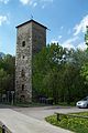
| 18.5 km | Ruhla clock museum - ( 380 m above sea level ) |
| 20 km | Location Thal with Schreiberbörnchen , Thalfried and the Scharfenburg - ( 290 m above sea level ) |
| 21 km | not far from the Kittelsthaler stalactite cave ( 348 m above sea level ) |
| 25 km | Through the Erbstromtal to Farnroda to the castle park - ( 275 m above sea level ) |
| 26.6 km | Destination: Wutha train station - ( 50 ° 57 ′ 24.2 ″ N , 10 ° 23 ′ 46.7 ″ E ) - ( 430 m above sea level ) Kleiner Hörselberg, connection to the Thuringian city chain |
Impressions

Start: Barchfeld Am Marktplatz

View towards Schweina (Schäfers Ruh)

At the kissel

Ruhla: clock museum
Farnroda Castle Park

Destination: Wutha train station
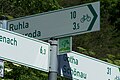
Connection to the national cycle path network


literature
- District Office Wartburgkreis (Ed.): Leaflet for the Tannhäuser Cycle Route . Bad Salzungen 2010.