Hereditary current
| Hereditary current | ||
|
Hereditary power source |
||
| Data | ||
| Water code | EN : 4166 | |
| location | Wartburgkreis , Thuringia , Germany | |
| River system | Weser | |
| Drain over | Hörsel → Werra → Weser → North Sea | |
| source | near Ruhla am Gerberstein in the Thuringian Forest 50 ° 51 '43 " N , 10 ° 23' 53" E |
|
| Source height | approx. 645 m above sea level NN | |
| muzzle | in Wutha in the Hörsel Coordinates: 50 ° 57 ′ 32 " N , 10 ° 23 ′ 42" E 50 ° 57 ′ 32 " N , 10 ° 23 ′ 42" E |
|
| Mouth height | 233.5 m above sea level NN | |
| Height difference | approx. 411.5 m | |
| Bottom slope | approx. 30 ‰ | |
| length | 13.5 km | |
| Catchment area | 58.4 km² | |
| Left tributaries | Mosbach | |
| Right tributaries | Krebsbach | |
| Small towns | Ruhla | |
| Communities | Wutha Farnroda | |


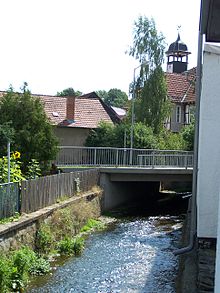
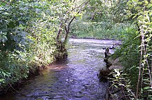
The Erbstrom is an approximately 13.5 km long, southern and orographically left-hand tributary of the Hörsel in the Wartburg district in West Thuringia and namesake of the Erbstromtal valley .
Surname
The original name of the river has been passed down as Ruhlaha in the upper reaches and has been preserved as the place name of Ruhla. In the lower reaches, from Farnroda, the Erbstrom was also called Wutha-Bach , this was the name derived from the early medieval water name Wuthaha , to which the small settlement Wutha owes its name.
course
The hereditary current originates in the Thuringian Forest about 3.5 km southeast of the city center of Ruhla . Its source is on the northern flank of the Gerberstein ( 728.5 m above sea level ) on the Frankenlandwiese , an area on the provincial road 1027 between Winterstein and Steinbach in the immediate vicinity of the Rennsteig . There is a marker stone with the inscription Erbstromquelle , restored in 1994 , which is located at about 645 m above sea level. NN is located. Other streams and rivulets such as the Kalter Rümpler and the Rolla stream flow in close succession below the source of the stream.
Initially, the hereditary current, which runs predominantly northwards, flows to Ruhla, whose southern outskirts it reaches at the Ruhla stadium . In the following 5 km of its flow stretch to the northern outskirts of the city, the river was used intensively for centuries by handicrafts and trades and was also permanently polluted. In the urban area, the course can only be traced in sections due to overbuilding and sewerage measures.
Between Ruhla and its district of Thal , the Erbstrom has an almost wild and natural character. In the local situation of Heiligenstein and valley of the direction of flow Seebach coming Krebsbach and other streams one.
The hereditary current then flows along the federal highway 88 through Farnroda , to finally, after taking up its last inflow, the Mosbach , in Wutha after crossing under the federal highway 7 and Thuringian Railway at 233.5 m above sea level. NN to flow into the Werra tributary Hörsel .
Economic history
Importance for mining
The significance of the water names Erbwasser , Erbbach and Erbstrom , which were also common in the mining areas around Schmalkalden and Suhl in the 17th century , is borrowed from mining . This natural watercourses were in the files indicated, the rights to use certain time or permanently to the operators of Pochwerken , hammer mills , grinding cottas and other mill buildings were transferred, including one provided with weirs water and trades ditches approach led to the mill wheels.
In the lower reaches, the hereditary current fed the Farnrodaer Schloßteich and other fish ponds located at Am Schunkenhof . In the 19th century there was a paper mill in Wutha , now the Petkus Wutha company premises are located there .
Interventions in the river course
As a basis for the construction of the UMK-Ruhla social building, which began in the early 1970s, at what was then the bus station in Ruhla, the course of the river had to be relocated over a length of around 500 meters. The river bed, which is still in use today, runs underground in a channel made of around 1000 concrete elements that were delivered by the Sömmerda building materials combine. The laying took place in the spring and summer of 1970. Until the final acceptance in the summer of 1971, sewer connections and pipe networks were laid in this area. A stable cover layer of gravel and compacted earth about one meter thick was filled over the canal. During the construction work, an existing artificial "waterfall" in this section was removed, which has been a popular meeting point for the people of Ruhla for decades.
The course of the rivers within Thal, Farnroda and Wutha was also secured by dams and concrete walls. Initially, the Thal-Seebach road was also relocated in 1970 and a rain retention basin was created in Fuchsgrund; it also serves as a service and extinguishing water basin for the adjacent industrial areas. The local connecting road leading to Thal was relocated to Farnroda, and two new bridges were built for this purpose. The meadow area south of the main building of the Petkus Wutha company up to Triftweg had initially remained undeveloped due to frequent floods. The canalization of the hereditary current and the inlet on Triftweg also took place in the 1970s. The stone vault bridge over the Erbstrom in Eisenacher Straße was no longer able to cope with the modern traffic volume in the 1940s, and the successor building was also replaced in the 2000s.
literature
- Klaus Schmidt (Red.): Running waters in the Wartburg district. Current situation and sustainable development. Published by the Lower Nature Conservation Authority and the Lower Water Authority of the Wartburg district . Wehry-Druck (Untermaßfeld), 2002, ZDB -ID 2288744-1 , p. 52 ( nature conservation in the Wartburg district 11).
Web links
Individual evidence
- ↑ a b c d Topographic map 1: 25,000
- ^ Thuringian State Institute for the Environment (ed.): Area and waterway key figures (directory and map). Jena 1998. 26 pp.
- ↑ Newspaper archive - www.diehallos.de - Biotope of the Month March , accessed on June 16, 2009
- ↑ The Erbstrom. In: Between Ruhla, Bad Liebenstein and Schmalkalden (= values of our homeland . Volume 48). 1st edition. Akademie Verlag, Berlin 1989, p. 53.
- ↑ Egon Wolfarth: The Erbstrom disappears under concrete and granite . In: The people . Eisenach April 18, 1970.
