Redwood River
| Redwood River | ||
|
Map of the catchment area |
||
| Data | ||
| location | Minnesota , United States | |
| River system | Mississippi River | |
| Drain over | Minnesota River → Mississippi → Gulf of Mexico | |
| source | Aetna Township, Pipestone County 44 ° 10 ′ 3 ″ N , 96 ° 10 ′ 18 ″ W. |
|
| Source height | 582 m | |
| muzzle | At Redwood Falls , Redwood County in the Minnesota River coordinates: 44 ° 34 ′ 16 " N , 95 ° 5 ′ 18" W, 44 ° 34 ′ 16 " N , 95 ° 5 ′ 18" W |
|
| Mouth height | 252 m | |
| Height difference | 330 m | |
| Bottom slope | 1.6 ‰ | |
| length | 205 km | |
| Catchment area | 1826 km² | |
| Drain |
MQ |
4 m³ / s |
|
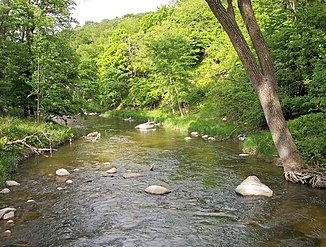
Redwood River in Camden State Park (2007) |
||
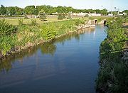
The Redwood River is a 205 km long tributary of the Minnesota River in the southwest of the US state Minnesota . Over the Minnesota River it is part of the catchment area of the Mississippi River and drains an area of 1826 km² in an agricultural region. It is believed that the name of the river is derived from the reddish bark of the horn shrub that grows along the waters in the region.
The source of Redwood Rivers is located in Aetna Township in the northeast of Pipestone County , about six kilometers west of Ruthton on the Coteau des Prairies , a moraine - Plateau , which from that of the catchment area of the Mississippi River Missouri River separates. Initially, the river flows as a non-permanent creek through Ruthton into northwest Murray County and then north into Lyon County , where it changes direction to the northeast and flows through Russell , Lynd, and Marshall . Between Russell and Marshall, the river leaves the plateau in a wooded valley and falls 90 m within 15 miles; Camden State Park is on this stretch of the river.

Below Marshall, the Redwood flows through a flat plain and then turns east into Redwood County , where it passes Vesta and Seaforth . Parts of this river section have been converted into agricultural moats . At Redwood Falls , the river enters the wooded valley of the Minnesota River. In the Alexander Ramsey City Park , he descends 30 m over granite steps over a distance of less than two kilometers. Shortly after passing the city, the Redwood River flows into the Minnesota River.
A dam that forms Redwood Lake in Redwood Falls originally served as a hydroelectric power station , but is now only maintained for recreational purposes.
The main tributaries to the Redwood River are the 60 km long Coon Creek , which rises from Lake Benton in Lincoln County and flows into Russell after a western run, the Three Mile Creek , which rises in Lincoln County and about 81 km in the northeast and then in the southeast Direction flows through Lyon County and then flows downstream from Marshall into the Redwood River, as well as the 16 km long Ramsey Creek , which connects to the Redwood River via a waterfall in Redwood Falls.
About 82% of the Redwood River's catchment area is used for agriculture, primarily for growing corn and soy . Hundreds of kilometers of watercourses have been straightened as a result and serve agricultural purposes.
Flow rate
At the gauge of the United States Geological Survey near Redwood Falls, 13.7 km above the river mouth, the mean annual runoff between 1909 and 2005 was 4 m³ / s. The largest amount of water flowed on June 18, 1957, when 558 m³ / s were measured. The lowest flow rate was 0 m³ / s. This value occurred on several days in 1940 and 1959.
See also
Individual evidence
- ^ A b Thomas F. Waters: The Southwest: Rivers of the Coteau des Prairies . In: The Streams and Rivers of Minnesota . University of Minnesota Press , Minneapolis 2006, ISBN 0-8166-0960-8 , pp. 288-303.
- ^ A b Minnesota Atlas & Gazetteer . DeLorme , Yarmouth, Me. 1994, ISBN 0-89933-222-6 , pp. 28-30.
- ↑ a b c Watersheds of the Minnesota River Basin. . Minnesota Pollution Control Agency. S. Minnesota River Basin: Redwood River Watershed . December 1, 2005. Archived from the original on February 5, 2007. Info: The archive link was automatically inserted and not yet checked. Please check the original and archive link according to the instructions and then remove this notice. Retrieved June 3, 2007.
- ^ Redwood River Major Watershed. . Minnesota River Basin Data Center. Minnesota State University, Mankato . S. Streams within the Redwood River Major Watershed . June 6, 2000. Retrieved June 3, 2007.
- ^ GB Mitton, KG Guttormson, GW Stratton, ES Wakeman: Water Resources Data in Minnesota, Water Year 2005 Annual Report. . United States Geological Survey . S. Redwood River near Redwood Falls, MN (PDF; 147 kB). Retrieved June 3, 2007.

