Richmond (London)
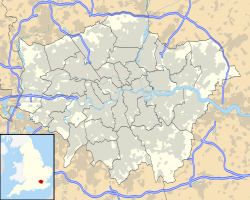
Location of Richmond in Greater London |
Richmond has been a borough of London since 1965 and is located in the London Borough of Richmond upon Thames in south-west London , about 8.2 miles southwest of central London. Previously, the parish belonged to the Municipal Borough of Richmond in Surrey from 1890 . Richmond is on the southeast side of the Thames .
population
In 2011, Richmond had a population of 21,469 people spread across 9,215 households.
| district | population | households | Area (in ha ) |
|---|---|---|---|
| North Richmond | 10,649 | 5,168 | 272 |
| South Richmond | 10,820 | 4,047 | 266 |
German residents
The city and borough of Richmond have been a popular destination for German expats and Anglo-Germans since the 19th century. The German businessman Sir Max Waechter donated Glover's Island to the community in 1900 . The German School London opened in nearby Petersham in 1971 and continues to promote its continued popularity with German families settling in London to the present day.
Attractions
- White Lodge , mansion built in 1727, now the seat of the Royal Ballet School
- Richmond Park , the largest of the Royal Parks in London at 10 km²
- the Museum of Richmond
Infrastructure
Thirty percent of Richmond households do not have a car. The proportion is thus well above the average of 24% of the city district, which can be connected with the excellent transport connections in the area and the high proportion of single households according to the 2001 census. Half of the households own a car, which is the average for the borough.
Public transport
-
Richmond Railway Station
- District Line to Upminster
- London Overground via Kew Gardens , Willesden Junction to Stratford
- South Western Railway express and suburban trains to Waterloo , Reading , Windsor , Wimbledon and Chiswick
-
North Sheen Railway Station
- Suburban trains of the South Western Railway on two ring lines via Hounslow and Wimbledon to Waterloo
Road traffic
Richmond's main artery, the A316, runs between Chiswick and the M3. It cuts off the Old Deer Park in the north of the city. The four-lane road, built in the 1930s, separates Richmond from Kew and resulted in the construction of the Twickenham Bridge. Eight kilometers west of Richmond, the road widens to six lanes.
The city center is on the A307, which was once the main link between London and northwest Surrey. This road used to be one of the main routes to Portsmouth before it was relocated.
Web links
Individual evidence
- ↑ key statistics; Quick Statistics: Population Density ( Memento of the original from March 4, 2016 in the Internet Archive ) Info: The archive link was inserted automatically and has not yet been checked. Please check the original and archive link according to the instructions and then remove this notice. on neighbourhood.statistics.gov.uk
Coordinates: 51 ° 27 '22 " N , 0 ° 18' 4" W.


