Rivière Châteauguay
|
Rivière Chateauguay Chateaugay River |
||
|
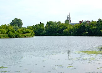
Rivière Châteauguay near Sainte-Martine |
||
| Data | ||
| Water code | US : 969989 | |
| location |
Québec (Canada), New York (USA) |
|
| River system | Saint Lawrence River | |
| Drain over | Saint Lawrence River → Atlantic Ocean | |
| origin |
Upper Chateaugay Lake 44 ° 45 ′ 56 " N , 73 ° 58 ′ 23" W. |
|
| Source height | 399 m | |
| muzzle |
Lac Saint-Louis coordinates: 45 ° 24 ′ 4 " N , 73 ° 45 ′ 10" W 45 ° 24 ′ 4 " N , 73 ° 45 ′ 10" W. |
|
| Mouth height | 21 m | |
| Height difference | 378 m | |
| Bottom slope | 3.1 ‰ | |
| length | 121 km | |
| Catchment area | 2543 km² | |
| Discharge at the gauge 2 km above route 132 A Eo : 2490 km² |
MQ 1971/2005 Mq 1971/2005 |
38 m³ / s 15.3 l / (s km²) |
| Left tributaries | Rivière Trout | |
| Right tributaries | Rivière des Anglais | |
| Reservoirs flowed through | Lower Chateaugay Lake | |
| Medium-sized cities | Chateauguay | |
| Small towns | Huntingdon | |
| Communities | Chateaugay , Ormstown , Sainte-Martine | |
|
Pont de Powerscourt |
||
The Rivière Châteauguay (in the USA : Chateaugay River ) is a right tributary of the Saint Lawrence River in the Canadian province of Québec and in the US state of New York .
The river has its origin in Upper Chateaugay Lake in Franklin County, New York . It flows north to Canada. It flows through the Lower Chateaugay Lake and overcomes the High Falls at Chateaugay . To the north of the border, the river is spanned by a covered bridge , the Pont de Powerscourt . The Rivière Châteauguay passes the small town of Huntingdon , where the Rivière Trout flows into it on the left. It then turns to the northeast and flows through the administrative region of Montérégie . After flowing through the municipality of Ormstown , the Rivière des Anglais flows into the river on the right. The commune of Sainte-Martine is then on the right bank of the river. Finally, the Rivière Châteauguay reaches the city of the same name, Châteauguay, and flows with two branches of the river opposite Montréal into Lac Saint-Louis, through which the Saint Lawrence River flows .
The Rivière Châteauguay has a length of 121 km. It drains an area of 2543 km². The mean discharge at the gauge 2 km above route 132 is 38 m³ / s.
Web links
Individual evidence
- ^ Upper Chateaugay Lake in the Geographic Names Information System of the United States Geological Survey
- ↑ a b Bureaulösungen publiques sur l'environnement du Québec (PDF; 100 kB)
- ↑ Water Survey of Canada: Station 02OA054 ( Memento of the original from December 24, 2010) Info: The archive link was automatically inserted and not yet checked. Please check the original and archive link according to the instructions and then remove this notice.
- ^ Chateaugay River in the Geographic Names Information System of the United States Geological Survey
- ^ Commission de toponymie du Québec: Rivière Châteauguay

