Rossberg (Haardt)
| Rossberg | ||
|---|---|---|
|
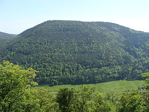
View from the Frankenfelsen over the Modenbach |
||
| height | 637 m above sea level NHN | |
| location | at Ramberg ; District of Südliche Weinstrasse , Rhineland-Palatinate ( Germany ) | |
| Mountains | Haardt , Palatinate Forest | |
| Coordinates | 49 ° 15 '43 " N , 8 ° 1' 46" E | |
|
|
||
The Roßberg near Ramberg in the Rhineland-Palatinate district of Südliche Weinstrasse is 637 m above sea level. NHN the third highest mountain in the Palatinate Forest .
geography
location
The Roßberg rises in the Palatinate Forest-Vosges du Nord biosphere reserve and in the Palatinate Forest Nature Park . Its summit rises 1.5 km east of the municipality of Ramberg on the district of 3.7 km (as the crow flies ) to the south-east of the municipality of Burrweiler .
Parts of the Haardtrand bird sanctuary extend to the eastern flank of the wooded Roßberg (VSG no. 6514-401; 147.28 km² ).
Natural allocation
The Roßberg belongs to the Palatinate Forest natural area, which is classified as a 3rd order Greater Region in the systematics of the handbook of the natural spatial structure of Germany published by Emil Meynen and Josef Schmithüsen and its subsequent publications . Looking at the internal structure of the natural area , the Roßberg belongs to the Middle Palatinate Forest and here to the Haardt mountain range, which separates the Palatinate Forest from the Upper Rhine Plain .
In summary, the natural spatial allocation of the Roßberg follows the following system:
- Greater region 1st order: Layer level land on both sides of the Upper Rhine Rift
- Greater region 2nd order: Palatinate-Saarland layer level land
- Greater region 3rd order: Palatinate Forest
- 4th order region (main unit): Middle Palatinate Forest
- 5th order region: Haardt
Flowing waters
The cold water spring is on the northern flank of the Roßberg , and the Ziegelbach rises on the east side ; both feed the Modenbach flowing north of the mountain . The Ohlsbach rises in the southwest , a small tributary of the Dernbach, which runs through Ramberg to the west of the mountain . The source of the Hainbach , a tributary of the Woogbach, is located on the southeast slope .
Traffic and walking
To the west and north past the Roßberg, the state road 506 leads first in the Dernbach valley and then in the Modenbach valley , which connects Ramberg in the west and Weyher in the Palatinate in the east. At the northern foot of the mountain, below the Meistersel Castle ( Modeneck ruins ; 491.5 m ) in the Modenbach Valley, lies the Modenbacherhof (approx. 307 m ); there branches off from the L 506, the timber house Heldenstein and the northern neighbor Berg Kesselberg ( 661.8 m ) and passing by Edenkoben leading County Road 6 from. Somewhat downstream, the K 58 branches off from the L 506, which runs to Burrweiler. On the summit region there is a small clearing that can be reached from the south via a forest path; there is a high seat .
Web links
Individual evidence
- ↑ a b LANIS: Roßberg on a topographical map from the map service of the landscape information system of the Rhineland-Palatinate nature conservation administration. Retrieved May 16, 2017 .
- ↑ Map services of the Federal Agency for Nature Conservation ( information )
- ↑ Adalbert Pemöller: Geographical land survey: The natural spatial units on sheet 160 Landau i. d. Palatinate. Federal Institute for Regional Studies, Bad Godesberg 1969. → Online map (PDF; 4.2 MB)
- ↑ Helmut Beeger u. a .: The landscapes of Rheinhessen-Pfalz - naming and spatial delimitation. In: Reports on German regional studies , Volume 63, Issue 2, Trier, 1989, pp. 327–359


