Romberg (Taunus)
| Romberg | ||
|---|---|---|
|
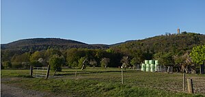
Romberg (left) next to the castle hill of Königstein Castle |
||
| height | 540.6 m above sea level NHN | |
| location | near Königstein im Taunus ; Hochtaunuskreis , Hessen ( Germany ) | |
| Mountains | Taunus | |
| Coordinates | 50 ° 11 '37 " N , 8 ° 27' 13" E | |
|
|
||
| particularities | - Billtalhöhe - Josefskapelle - Wegekreuz - Kreuzweg Romberg |
|


The Romberg in the Taunus low mountain range is 540.6 m above sea level. NHN high mountain near Königstein im Taunus in the Hessian Hochtaunus district .
etymology
The name of the mountain comes from the fact that on its southern slope the woolen weavers from Königstein had put up their dyed cloth on frames (regional dialect: "Rohmen"). Various forms of name are historically documented, such as Ronenberg, Raneberg (1488), Ronberck (1576) and Rummerskopf (1796).
geography
location
The Romberg rises in the Taunus Nature Park . Its summit is 1.4 km northwest of the center of the core town of Königstein im Taunus , 1.8 km west-northwest of Falkenstein and 4.3 km northeast of Ruppertshain . North and east passing extends between Königstein and glassworks the Federal Highway 8 (Limburger Strasse) . From this branch in Königstein, the state road 3369 (Ölmühlweg) branches off, which leads westwards to Ruppertshain.
To the east and south past the Romberg, the Reichenbach (Woogbach) flows as a left tributary of the Liederbach , whose right source, Rombach , rises west of the mountain.
Natural allocation
The Romberg belongs to the natural spatial main unit group Taunus (No. 30) and in the main unit Hoher Taunus (301) to the subunit Feldberg-Taunuskamm (301.3). Its landscape falls to the southeast in the main unit Vortaunus (300) and in the sub-unit Altkönig Vorstufe (300.2) in the natural area Königsteiner Taunusfuß (300.20).
Billtalhöhe
About 1.3 km southeast of the Eselsheck mountain pass on the B 8 , the Borgnisweg, which runs through the forest, branches off the main road to the northwest on the Billtalhöhe. The valley sloping south from there, the Billtal, represents the western boundary of the Romberg. The former restaurant Restauration zur Billtalhöhe , built in 1901/1902 in the country house style, is on the Billtalhöhe ( ⊙ ). The inn , now a listed building , was a popular excursion destination for Königstein spa guests and the Taunids until the First World War . The building is a single-storey solid construction on a rectangular floor plan. A staircase tower is built on slightly to the side.
Joseph Chapel
Lower on the mountain, above the Speckerholweg, stands the Josefskapelle ( ⊙ ), consecrated in 1908 and now a listed building. The previous building was built in 1727 on Gaisberg ( Villa Andreae ) by the Königstein construction guild and destroyed by the French in 1792. The chapel, which was changed during renovation work in the 1960s, is a quarry stone building with a gable roof. A porch made of round arches is freely accessible. The chapel room is decorated with a painting by Robert Hieronymi that shows St. Joseph.
Wayside cross
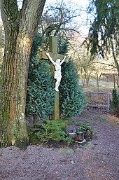
Between the Königsteiner Friedhof and the Josefskapelle there is a listed wayside cross ( ⊙ ) made of red Main sandstone . A brightly contrasting Christ is attached. The base is of more recent date and bears the inscription according to Joh. 11, 25: “I am the resurrection and the life. Whoever believes in me will live even if he dies ” .
Way of the Cross Romberg
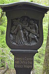
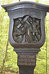
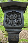
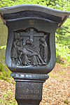
A Way of the Cross was built after the Second World War . Its 12th cross is an old stone cross from 1776, which stands between two votive stones of the 14 emergency helpers from 1754. The Way of the Cross begins at the wayside cross, leads past the Joseph Chapel to a stone saint's house. The Stations of the Cross 1 to 10 follow in a short distance. These consist of wooden columns with a carved motif on the top. The oak pillars were carved by Johannes Belz in 1949. The Way of the Cross leads in the form of a mirror-inverted "S" to a place where stations 11 to 14 form a semicircle. The entire facility is under monument protection. The individual stations at a glance:
| Station ( geo-coordinates ) |
photo | description |
|---|---|---|
| Holy House ( ⊙ ) |
 |
|
| Station 1 ( ⊙ ) |
 |
|
| Station 2 ( ⊙ ) |
 |
|
| Station 3 ( ⊙ ) |
 |
|
| Station 4 ( ⊙ ) |
 |
|
| Station 5 ( ⊙ ) |
 |
|
| Station 6 ( ⊙ ) |
 |
|
| Station 7 ( ⊙ ) |
 |
|
| Station 8 ( ⊙ ) |
 |
|
| Station 9 ( ⊙ ) |
 |
|
| Station 10 ( ⊙ ) |
 |
|
| Station 11 ( ⊙ ) |
 |
|
| Station 12 ( ⊙ ) |
 |
|
| Station 13 ( ⊙ ) |
 |
|
| Station 14 ( ⊙ ) |
 |
History
According to tradition, there should have been a sanctuary on Romberg in pre-Christian times. The first cross was erected in its place in 745. Count Gerhard von Nürings is said to have built a choir niche there in 1147 .
A chapel on the Romberg was first documented in the plague year 1348. The Retters monastery had therefore introduced petitions to the mountain. The resulting Holy Cross processions on Whit Monday were from then until 1667 and are again part of the religious life of the city from the early 19th century until today. In 1631 the chapel was destroyed by the Swedes.
Pastor Kraft erected a wooden cross on the site of the former chapel. In 1754, Rector Johann Eschborn had two votive stones set up on behalf of his father-in-law Georg Burckharth . These show the 14 helpers in need . The reason was an accident that had been prevented after wood workers had called the 14 emergency workers. In 1776, the married couple Georg and Katarina Kreiner had the wooden cross replaced by today's stone cross.
Individual evidence
literature
- Eva Rowedder: Hochtaunuskreis . Ed .: State Office for Monument Preservation Hessen (= monument topography Federal Republic of Germany , cultural monuments in Hessen ). Konrad Theiss Verlag, Darmstadt 2013, ISBN 978-3-8062-2905-9 , pp. 262-263 .
- Hermin Herr: Lexicon from the High Taunus. Kramer, Frankfurt am Main 1993, ISBN 3-7829-0437-0 , p. 94.
