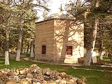
Söğüt
| Söğüt | ||||
|
||||
| Basic data | ||||
|---|---|---|---|---|
| Province (il) : | Bilecik | |||
| Coordinates : | 40 ° 1 ' N , 30 ° 11' E | |||
| Height : | 692 m | |||
| Residents : | 13,930 (2018) | |||
| Telephone code : | (+90) 228 | |||
| Postal code : | 11 600 | |||
| License plate : | 11 | |||
| Structure and administration (as of 2019) | ||||
| Structure : | 5 malls | |||
| Mayor : | İsmet Sever ( MHP ) | |||
| Website: | ||||
| District of Söğüt | ||||
| Residents : | 19,244 (2018) | |||
| Surface: | 523 km² | |||
| Population density : | 37 inhabitants per km² | |||
| Kaymakam : | Mitat Gozen | |||
| Website (Kaymakam): | ||||
Söğüt is a city and a district in the Turkish province of Bilecik . The city is located about 25 kilometers southeast of the provincial capital Bilecik . The city is home to about 72 percent of the district's population.
Söğüt was the place of origin of the Ottoman Empire and from 1299-1326 the seat of the Ottoman dynasty .
geography
The district is located in the southeast of the province. It borders in the southwest on Bozüyük , in the northwest on the central district, in the north on Gölpazarı , in the east on İnhisar and in the southeast on the Eskişehir province . A connecting road from Bilecik to Eskişehir runs through Söğüt . In the south of the district are the foothills of the Sündiken Dağları Mountains . In the extreme south lies the Zemzemiye Göleti lake, near the prehistoric site Demircihöyük . The Kızıldamlar dam is 7 km west of the district town .
In addition to the district town, the district also consists of 23 villages ( Köy ) with an average population of 231 inhabitants. Two of them have more than a thousand inhabitants: Çaltı (1,166) and Küre (1,033 inh.).
Personalities
- Ertuğrul Gazi , Turkmen / Oghuz clan leader and father of Osman I.
- Osman I. , founder of the Ottoman dynasty and the Ottoman Empire
literature
- Johannes Hendrik Kramers: Sögüd In: The Encyclopaedia of Islam. New Edition . Vol. 9, Brill, Leiden, p. 706.
Web links
Individual evidence
- ↑ a b Türkiye Nüfusu İl ilçe Mahalle Köy Nüfusları , accessed on May 18, 2019


