Shalushka
Village
|
||||||||||||||||||||||||||||||
|
||||||||||||||||||||||||||||||
|
||||||||||||||||||||||||||||||
| List of large settlements in Russia | ||||||||||||||||||||||||||||||
Schaluschka ( Russian Шалу́шка ; Kabardian Щхьэлыкъуэ / Schhelyqwe ) is a village (selo) in the Republic of Kabardino-Balkaria in Russia with 11,158 inhabitants (as of October 14, 2010).
geography
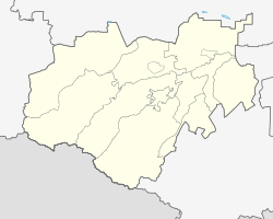
The place is located on the northern edge of the Greater Caucasus about 6 km as the crow flies northwest of the center of the republic capital Nalchik on the left bank of the river of the same name, which flows into the Baksan via Urwan and Tscherek , and its left tributary Kamenka.
Shalushka belongs to the Tschegemsky Rajon and is located about 4 km south of the center of its administrative seat Tschegem . The village is the seat and only locality of the rural community (selskoje posselenije) Shalushka.
history
The exact year the town was founded is unknown; The remains of tombs indicate settlement since the 13th century. In the first half of the 19th century the Kabardian ( Circassian ) Aule with the Russified names Dautokowo, Kunischewo, Laukezewo and Schardanowo were located on the territory of today's village . In 1865 they were united under the name Schardanowo, the largest of the Aule. After the October Revolution , this name was replaced in 1920 as a derivation from the name of a noble family by the name of the river, Russified from the Cabardian -Circassian shhel (щхьэл) for mill and qwe ( къуэ ) for ravine, valley, so for example "mill valley" .
Population development
| year | Residents |
|---|---|
| 1970 | 5,760 |
| 1979 | 7,538 |
| 2002 | 11,240 |
| 2010 | 11,158 |
Note: census data
traffic
The old route of the federal highway R217 Kawkas (formerly M29) leads past the northeastern edge of the village, which has been expanded to form a multi-lane expressway connecting Nalchik and Tschegem. The road running through the village continues through the village of Janikoi , which is immediately adjacent to the west, to Letschinkai , where it joins the road that follows the Tschegem river upwards.
The nearest train station is in Nalchik.
Individual evidence
- ↑ a b Itogi Vserossijskoj perepisi naselenija 2010 goda. Tom 1. Čislennostʹ i razmeščenie naselenija (Results of the All-Russian Census 2010. Volume 1. Number and distribution of the population). Tables 5 , pp. 12-209; 11 , pp. 312–979 (download from the website of the Federal Service for State Statistics of the Russian Federation)

