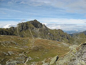
Schiedeck
| Schiedeck | ||
|---|---|---|
|
Schiedeck from the south |
||
| height | 2339 m above sea level A. | |
| location | Styria , Austria | |
| Mountains | Schladminger Tauern , Lower Tauern | |
| Dominance | 1.92 km → Kampspitze | |
| Notch height | 165 m ↓ notch to Kampspitze | |
| Coordinates | 47 ° 18 '42 " N , 13 ° 39' 1" E | |
|
|
||
| rock | Crystalline | |
| particularities | Patzenkar European Protected Area | |
The Schiedeck is a 2339 m above sea level. A. high mountain in the Schladminger Tauern . The summit is in the immediate vicinity of the Schladminger Höhenweg and is often climbed in combination with it.
Location and surroundings
The Schiedeck is located in the central Schladminger Tauern in the middle Schiedeckkamm , which stretches from the Giglachseen in the south to the Hochwurzen in the north. Despite its eponymous function, the Schiedeck is only the second highest peak on the ridge after Kampspitze ( 2390 m ), a good two kilometers south .
To the northeast, the 130-hectare European protected area (in accordance with the Habitats Directive ) adjoins Patzenkar , which is of great interest from a vegetation perspective , among other things because of its grass communities .
Geology and geomorphology
The geological structure of the mountain is typically relatively complex in the crystalline nature of the Niedere Tauern . While the summit area consists of biotite - chlorite phyllite , migmatic paragneiss , quartzite and, above all , rubble- bearing quartzite phyllite occur in the slope areas . In the upper Patzenkar between Schiedeck, Kornreitwipfl ( 2169 m ) and Edelweißwand , moraine material and several small cirque lakes bear witness to the glacial character of the last glacial periods . In addition, blocks and debris can be seen all around as recent phenomena .
Ascent
The Schiedeck is popular with hikers in summer as well as ski tourers in winter . A short, marked hiking trail branches off from the long but easy Schladminger Höhenweg at around 2200 m above sea level. A total of around 30 minutes should be planned for the ascent and descent for the detour to the green summit.
Starting points
- Ignaz Mattis Hut : 2 hours
- Giglachseehütte : 2½ hours
- Hochwurzenhütte : 3 - 3½ hours
- Hochwurzen valley station, Rohrmoos : 5 - 5½ hours
panorama
Literature and maps
- Günter and Luise Auferbauer: Mountain tour paradise Styria. All 2000s from Dachstein to Koralpe. Styria, Graz 2000, p. 218, ISBN 3-222-12783-2 .
- Freytag & Berndt Vienna , hiking map 1: 35,000, WK 5201, Schladming - Ramsau a. Dachstein - House i. Ennstal - Filzmoos - Stoderzinken , ISBN 978-3707910872 .
Web links
Individual evidence
- ↑ Günter and Luise Auferbauer: hike paradise Styria. All 2000s from Dachstein to Koralpe. (see literature)
- ↑ Natura 2000 - Patzenkar. State of Styria , accessed December 12, 2015 .
- ↑ Information folder Patzenkar. State of Styria , accessed December 12, 2015 . (PDF; 1.69 MB)
- ↑ Digital Atlas of Styria: Geology & Geotechnics. (No longer available online.) State of Styria , archived from the original on June 15, 2012 ; Retrieved December 12, 2015 . Info: The archive link was inserted automatically and has not yet been checked. Please check the original and archive link according to the instructions and then remove this notice.


