Schollbrunn (Waldbrunn)
|
Schollbrunn
Community Waldbrunn
|
|
|---|---|
| Coordinates: 49 ° 26 '8 " N , 9 ° 4' 42" E | |
| Height : | 460 m |
| Area : | 7.37 km² |
| Residents : | 643 (December 31, 2015) |
| Population density : | 87 inhabitants / km² |
| Incorporation : | 1st January 1973 |
| Postal code : | 69429 |
| Area code : | 06274 |
|
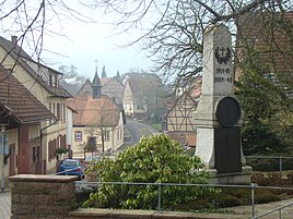
Center with memorial and chapel of St. Maria
|
|
Schollbrunn is a district of the municipality Waldbrunn in the Neckar-Odenwald district in Baden-Württemberg .
Geographical location
Schollbrunn is located in the southeastern part of the Odenwald in its red sandstone area on the Winterhauch , an elongated plateau that culminates 4.7 km further northwest in the highest mountain in the Odenwald, the Katzenbuckel ( 626.8 m above sea level ). The location is at the head of a valley cut that ends south in the Tiefensteigklinge before Neckargerach . The district covers 737 hectares, of which 302 hectares are forested.
Strümpfelbrunn , the main town in the Waldbrunn community, is located around three kilometers north of the center of Schollbrunn. In the north-west the district of Oberdielbach is neighboring and in the east the district of Weisbach , from which it is separated by the deep valley cut of the Weisbach .
history
The existence of the place can be traced back to 1368 in the spelling Schalbrun and Schalbrone . Although it is assumed that the Lords von Zwingenberg founded it before this time, the oldest documents that have survived only show that the Electoral Palatinate has rulership rights .
The massive choir tower is still preserved from the medieval parish church. Inside it bears the year 1367. The nave was rebuilt in the years 1736–1739 and the tower got its bell-shaped roof. The Schollbrunn Church was a branch church of Neckargerach well into the 19th century . In 1778 a chapel room was added to the existing Catholic schoolhouse. During the last renovation in 1982/1984, both parts of the building were combined into one chapel.
On January 1, 1973, Schollbrunn formed the new community of Waldbrunn with four other communities.
traffic
The state road L 634 leads through Schollbrunn from Oberdielbach to Neckargerach. In the center of the village, the district road K 3929 branches off to the east in the direction of Weisbach. In Oberdielbach there is a connection to the L 524, which leads over the Winterhauch from Eberbach to Mudau and in the Neckar Valley near Neckargerach, the federal highway 37 is accessible.
Individual evidence
- ^ Federal Statistical Office (ed.): Historical municipality directory for the Federal Republic of Germany. Name, border and key number changes in municipalities, counties and administrative districts from May 27, 1970 to December 31, 1982 . W. Kohlhammer, Stuttgart / Mainz 1983, ISBN 3-17-003263-1 , p. 478 .
Web links
- Schollbrunn on the website of the community Waldbrunn , accessed on December 7, 2018
- LEO-BW, discover regional studies online Schollbrunn

