
Schwalbach (Sulzbach)
| Schwalbach | ||
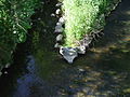
 The Schwalbach in Sulzbach |
||
| Data | ||
| Water code | DE : 248982 | |
| location | Main-Taunus-Kreis , Hessen Germany | |
| River system | Rhine | |
| Drain over | Sulzbach → Nidda → Main → Rhine → North Sea | |
| origin | Confluence of Waldbach and Sauerbornsbach in Schwalbach am Taunus 50 ° 8 ′ 52 ″ N , 8 ° 32 ′ 11 ″ E |
|
| Source height | approx. 132 m above sea level NHN | |
| muzzle | near the city of Sulzbach (Taunus) in the Sulzbach coordinates: 50 ° 7 '44 " N , 8 ° 32' 28" E 50 ° 7 '44 " N , 8 ° 32' 28" E |
|
| Mouth height | approx. 115 m above sea level NHN | |
| Height difference | approx. 17 m | |
| Bottom slope | approx. 6.5 ‰ | |
| length | 2.6 km (with Sauerbornbach 7.3 km) | |
| Catchment area | 18.353 km² | |
| Discharge A Eo : 18.353 km² at the mouth |
MNQ MQ Mq |
18 l / s 87 l / s 4.7 l / (s km²) |
The Schwalbach is an approximately two and a half kilometers long left and eastern tributary of the Sulzbach in the Hessian Main-Taunus-Kreis . It arises from the confluence of the Waldbach (right source stream ) and the Sauerbornsbach (left source stream).
Officially, the Sauerbornsbach is part of the Schwalbach body of water with the GKZ 248982. The total length of Sauerbornsbach and Schwalbach is about seven kilometers.
geography
course
The Schwalbach arises south of the Sauererlenstrasse in the town of Schwalbach am Taunus from the confluence of the Waldbach and Sauerbornsbach . After crossing Schwalbach, the Schwalbach flows through an area with fields and meadows, before finally flowing into the Sulzbach in the municipality of Sulzbach (south of the Mühlstrasse ) .
Nidda river system
Localities
The villages on the Schwalbach include (viewed downstream):
- Schwalbach am Taunus (Hesse)
- Sulzbach (Taunus) (Hesse)
Dates and character
The Schwalbach is a carbonate low mountain range rich in fine material .
Individual evidence
- ↑ a b Topographic Map 1: 25,000 and Google Earth
- ↑ a b Water map service of the Hessian Ministry for the Environment, Climate Protection, Agriculture and Consumer Protection ( information )
- ↑ Modeled discharge values according to the water body profile and program of measures 248982.1 ( Memento from January 1, 2013 in the web archive archive.today ) ( Notes ) → Overview of all Hessian river systems (PDF, 1.7 MB) Schwalbach
- ↑ Type 6: Carbonatic low mountain streams rich in fine material ( page no longer available , search in web archives ) Info: The link was automatically marked as defective. Please check the link according to the instructions and then remove this notice. (PDF; 177 kB)
Picture gallery

Confluence of the Schwalbach in the Sulzbach

Schwalbach

Schwalbach in Schwalbach

Schwalbach
Confluence of Waldbaches u. Sauerbornsbach to Schwalbach


Web links
- Water profile and program of measures 248982.1 ( Memento from January 1, 2013 in the web archive archive.today ) ( Notes ) → Overview of all Hessian river systems (PDF, 1.7 MB) Schwalbach