Semme (Gersprenz)
|
Semme Semder brook upper course: Hasselbach middle course: old brook |
||
|
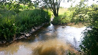
The Semme at Semd |
||
| Data | ||
| Water code | DE : 24764 | |
| location | Darmstadt-Dieburg district ( Hesse ) | |
| River system | Rhine | |
| Drain over | Gersprenz → Main → Rhine → North Sea | |
| source | north of Hassenroth 49 ° 47 ′ 54 ″ N , 8 ° 55 ′ 50 ″ E |
|
| Source height | approx. 330 m above sea level NHN | |
| muzzle | north of Hergershausen in the Gersprenz Coordinates: 49 ° 56 '43 " N , 8 ° 54' 35" E 49 ° 56 '43 " N , 8 ° 54' 35" E |
|
| Mouth height | approx. 130 m above sea level NHN | |
| Height difference | approx. 200 m | |
| Bottom slope | approx. 9.8 ‰ | |
| length | 20.5 km | |
|
The Semme flows into the Gersprenz |
||
The Semme , also called Semder Bach , is a right tributary of the Gersprenz in the Darmstadt-Dieburg district in Hesse .
geography
course
The upper reaches of the Semme lies in the municipality of Otzberg and carries the surname Hasselbach here . The source is at the southernmost point of the forest delimitation of the Lengfeld district in a forest valley on the Klingelskopf (361 m). The first 700 meters of the stream are on the border with the Odenwaldkreis . The northern outskirts of Hassenroth (Höchst im Odenwald) are only 200 meters away.
The Hasselbach first flows to the northwest past the melting mill , where it receives tributaries from various side valleys. Then the stream flows through Ober-Klingen , where it turns its course to the north and thus flows more than ten kilometers east parallel to the Gersprenz. The distance to her is around three kilometers. The next place on the stream is Nieder-Klingen . There he is called Old Bach . After crossing under the federal highway 426, the Semme flows through Habitzheim and Semd , crosses under the federal highway 45 and at Altheim the federal highway 26 as well as the route of the Rhein-Main-Bahn . North of Hergershausen , the Semme flows into the Gersprenz from the right and south.
Tributaries
- Hassenrother Bach (left)
- Beerbach (right)
- Bach from the Auwiese (left)
- Ditzenbach (left)
- Bach von der Aspe (right)
- Hollergraben (right)
- Sand ditch (right)
- Schweinsgraben-Sandgraben (left)
- Pigeon shirt (right)
- Banngraben (left)
- Herrngraben (left)

