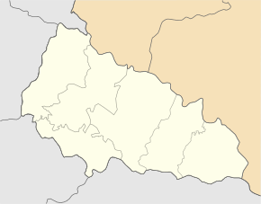
Serednje Vodjane
| Serednje Vodjane | ||
| Середнє Водяне | ||

|
|
|
| Basic data | ||
|---|---|---|
| Oblast : | Zakarpattia Oblast | |
| Rajon : | Rakhiv Raion | |
| Height : | 265 m | |
| Area : | 4.26 km² | |
| Residents : | 5,689 (2004) | |
| Population density : | 1,335 inhabitants per km² | |
| Postcodes : | 90613 | |
| Area code : | +380 3132 | |
| Geographic location : | 47 ° 59 ' N , 23 ° 54' E | |
| KOATUU : | 2123687001 | |
| Administrative structure : | 2 villages | |
| Address: | вул. Борканюка 2 90613 с. Середнє Водяне |
|
| Statistical information | ||
|
|
||
Serednye Wodjane ( Ukrainian Середнє Водяне ; russian Среднее Водяное Sredneje Wodjanoje , Slovak Stredná APSA , Hungarian Középapsa , Romanian APSA de Mijloc ) is a village in the southeastern Ukrainian Zakarpattia Oblast with about 5600 inhabitants (2004).
Serednje Wodjane is the administrative center of the district council of the same name in the southwest of the Rajon Rakhiv , to which the northern village of Dobrik ( Добрік ⊙ ) with about 1100 inhabitants belongs.
The 1428 first documentary mentioned village is a neighbor of the Tiachiv Raion located urban-type settlement Solotvyno and is located in the Carpathian Ukraine in the historic region of Maramures on the banks of Apschyzja ( Апшиця ), a 39 km long tributary of the Tisza . The village of Verkhnye Vodjane is 5 kilometers upstream .
The Rajon center of Rakhiv is located about 50 km by road to the northeast and the Uzhhorod oblast center is about 170 km northwest of Serednje Vodjane.
Web links
Individual evidence
- ↑ Serednje Vodjane on the official website of the Verkhovna Rada ; accessed on July 31, 2017 (Ukrainian)
- ↑ Information about the church at www.derev.org.ua ; accessed on July 31, 2017 (Ukrainian)


